
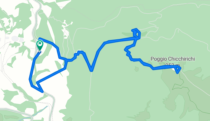
trekking per l'Eremita di Cesi
A cycling route starting in San Gemini, Umbria, Italy.
Overview
About this route
straordinario percorso francescno interamente in bosco fino al bellissimo romitorio
- -:--
- Duration
- 7.1 km
- Distance
- 509 m
- Ascent
- 509 m
- Descent
- ---
- Avg. speed
- ---
- Max. altitude
Route quality
Waytypes & surfaces along the route
Waytypes
Path
5.5 km
(78 %)
Track
0.8 km
(12 %)
Surfaces
Paved
0.1 km
(2 %)
Unpaved
2.6 km
(36 %)
Ground
1.4 km
(20 %)
Gravel
0.7 km
(9 %)
Continue with Bikemap
Use, edit, or download this cycling route
You would like to ride trekking per l'Eremita di Cesi or customize it for your own trip? Here is what you can do with this Bikemap route:
Free features
- Save this route as favorite or in collections
- Copy & plan your own version of this route
- Sync your route with Garmin or Wahoo
Premium features
Free trial for 3 days, or one-time payment. More about Bikemap Premium.
- Navigate this route on iOS & Android
- Export a GPX / KML file of this route
- Create your custom printout (try it for free)
- Download this route for offline navigation
Discover more Premium features.
Get Bikemap PremiumFrom our community
Other popular routes starting in San Gemini
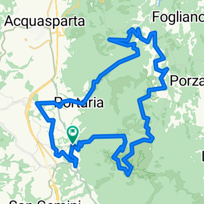
 Grand Tour della Montagna MTB dx
- Distance
- 144.8 km
- Ascent
- 2,765 m
- Descent
- 2,765 m
- Location
- San Gemini, Umbria, Italy
 trekking per l'Eremita di Cesi
- Distance
- 7.1 km
- Ascent
- 509 m
- Descent
- 509 m
- Location
- San Gemini, Umbria, Italy
 Carsulae - Percorso MTB
- Distance
- 21.5 km
- Ascent
- 695 m
- Descent
- 699 m
- Location
- San Gemini, Umbria, Italy
 EQQQQQ
- Distance
- 156.3 km
- Ascent
- 2,777 m
- Descent
- 3,414 m
- Location
- San Gemini, Umbria, Italy
 Grand Tour della Montagna Ternana n.6 (GF Antica Carsulae)
- Distance
- 36.2 km
- Ascent
- 1,111 m
- Descent
- 1,109 m
- Location
- San Gemini, Umbria, Italy
 Da Via Ternana 54, Acqua Vogliera a Via Ternana 83, Acqua Vogliera
- Distance
- 28.8 km
- Ascent
- 483 m
- Descent
- 488 m
- Location
- San Gemini, Umbria, Italy
 Terra dell'Acqua e dei Ciclamini - Percorso A
- Distance
- 57.1 km
- Ascent
- 567 m
- Descent
- 567 m
- Location
- San Gemini, Umbria, Italy
 narnihegy
- Distance
- 30.1 km
- Ascent
- 360 m
- Descent
- 615 m
- Location
- San Gemini, Umbria, Italy
Open it in the app