

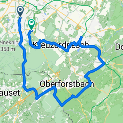
Rund um Aachen und über das Dreiländereck
A cycling route starting in Aachen, North Rhine-Westphalia, Germany.
Overview
About this route
Rund um Aachen
Ein Stück Vennbahnweg mit Pause in Kornelimünster
Ein schönes Stück durch den Aachener Wald
Dreiländereck: Niederlande - Belgien - Deutschland
- -:--
- Duration
- 44 km
- Distance
- 295 m
- Ascent
- 295 m
- Descent
- ---
- Avg. speed
- ---
- Max. altitude
Route highlights
Points of interest along the route
Point of interest after 10 km
Tivoli Alemannia Aachen
Point of interest after 10 km
Point of interest after 24.4 km
BahnhofsVision Gastronomie
Continue with Bikemap
Use, edit, or download this cycling route
You would like to ride Rund um Aachen und über das Dreiländereck or customize it for your own trip? Here is what you can do with this Bikemap route:
Free features
- Save this route as favorite or in collections
- Copy & plan your own version of this route
- Sync your route with Garmin or Wahoo
Premium features
Free trial for 3 days, or one-time payment. More about Bikemap Premium.
- Navigate this route on iOS & Android
- Export a GPX / KML file of this route
- Create your custom printout (try it for free)
- Download this route for offline navigation
Discover more Premium features.
Get Bikemap PremiumFrom our community
Other popular routes starting in Aachen
 Zweifall +Hohes Venn
- Distance
- 69.6 km
- Ascent
- 564 m
- Descent
- 564 m
- Location
- Aachen, North Rhine-Westphalia, Germany
 Durch den Aachener Stadtwald
- Distance
- 26.7 km
- Ascent
- 320 m
- Descent
- 320 m
- Location
- Aachen, North Rhine-Westphalia, Germany
 Durchs Hohe Venn
- Distance
- 72.7 km
- Ascent
- 713 m
- Descent
- 589 m
- Location
- Aachen, North Rhine-Westphalia, Germany
 Köpfchen-Lichtenbusch-Vennbahn
- Distance
- 26.9 km
- Ascent
- 193 m
- Descent
- 174 m
- Location
- Aachen, North Rhine-Westphalia, Germany
 Soers und Wurmtal
- Distance
- 16.1 km
- Ascent
- 145 m
- Descent
- 155 m
- Location
- Aachen, North Rhine-Westphalia, Germany
 nice MTB route
- Distance
- 21.7 km
- Ascent
- 442 m
- Descent
- 450 m
- Location
- Aachen, North Rhine-Westphalia, Germany
 TJs extreme :)
- Distance
- 50.6 km
- Ascent
- 615 m
- Descent
- 612 m
- Location
- Aachen, North Rhine-Westphalia, Germany
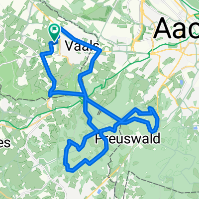 Vaals - Op jacht in het Preuswald
- Distance
- 23.6 km
- Ascent
- 424 m
- Descent
- 425 m
- Location
- Aachen, North Rhine-Westphalia, Germany
Open it in the app