
Pfingsten 2009-Reichenbach-Bismarkturm-Forsthaus-Bäckerloch-Mineralbad-Reichenbach
A cycling route starting in Callenberg, Saxony, Germany.
Overview
About this route
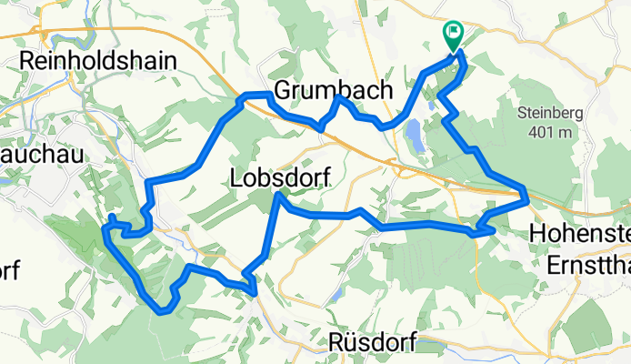
Start in Callenberg/ OT Reichenbach am Umlenkplatz. Route führt über:
Grumbach-Ebersbach-über die A4-vorbei an den alten Schieferbrüchen-Abfahrt nach Niederlungwitz-über den Bach-zum Forsthaus Nlgw.-hinauf zum Bismarkturm-Forsthaus Rümpftwald-St.Egidien Flussweg-Lobsdorf-Kuhschnappel-Bäckerloch-Heiterer Blick-Talstraße-Mineralbad-unter der A4-Höhenweg-Abfahrt bei Schmidts-alter Bahndamm-Mühlengrund-Umlenkplatz Reichnbach
- -:--
- Duration
- 30.3 km
- Distance
- 439 m
- Ascent
- 387 m
- Descent
- ---
- Avg. speed
- 391 m
- Avg. speed
Route quality
Waytypes & surfaces along the route
Waytypes
Track
13.6 km
(45 %)
Quiet road
9.4 km
(31 %)
Surfaces
Paved
14.4 km
(48 %)
Unpaved
14 km
(46 %)
Asphalt
10.6 km
(35 %)
Gravel
7.6 km
(25 %)
Continue with Bikemap
Use, edit, or download this cycling route
You would like to ride Pfingsten 2009-Reichenbach-Bismarkturm-Forsthaus-Bäckerloch-Mineralbad-Reichenbach or customize it for your own trip? Here is what you can do with this Bikemap route:
Free features
- Save this route as favorite or in collections
- Copy & plan your own version of this route
- Sync your route with Garmin or Wahoo
Premium features
Free trial for 3 days, or one-time payment. More about Bikemap Premium.
- Navigate this route on iOS & Android
- Export a GPX / KML file of this route
- Create your custom printout (try it for free)
- Download this route for offline navigation
Discover more Premium features.
Get Bikemap PremiumFrom our community
Other popular routes starting in Callenberg
 Langsame Fahrt in Hohenstein-Ernstthal
- Distance
- 36.5 km
- Ascent
- 1,068 m
- Descent
- 1,023 m
- Location
- Callenberg, Saxony, Germany
 Trainingsrunde
- Distance
- 45.8 km
- Ascent
- 448 m
- Descent
- 448 m
- Location
- Callenberg, Saxony, Germany
 Glänzelmühle-Remse-Waldenburg-Glänzelmühle
- Distance
- 17.6 km
- Ascent
- 140 m
- Descent
- 152 m
- Location
- Callenberg, Saxony, Germany
 31.01.2020
- Distance
- 4.6 km
- Ascent
- 66 m
- Descent
- 64 m
- Location
- Callenberg, Saxony, Germany
 Über Waldenburg zur Langenberger Höhe
- Distance
- 45.3 km
- Ascent
- 505 m
- Descent
- 507 m
- Location
- Callenberg, Saxony, Germany
 Waldenburg,Nobitz,Gnandstein,Kohren
- Distance
- 68.6 km
- Ascent
- 553 m
- Descent
- 550 m
- Location
- Callenberg, Saxony, Germany
 Anfahrt Glänzelmühle über A4 Abfahrt Hohenstein-Ernstthal
- Distance
- 6.6 km
- Ascent
- 11 m
- Descent
- 156 m
- Location
- Callenberg, Saxony, Germany
 Mtb.Runde übers Muldental
- Distance
- 44.1 km
- Ascent
- 482 m
- Descent
- 487 m
- Location
- Callenberg, Saxony, Germany
Open it in the app