

Konin-Oleśnica(2etapGrudziądz-Nachod)
A cycling route starting in Konin, Greater Poland Voivodeship, Poland.
Overview
About this route
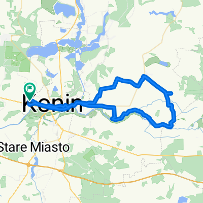
The route from Konin through Kalisz to Ostrow Wlkp. is a tragedy for cyclists: flat and monotonous. But the main drawback was the high traffic density, after all, it is national road 25, and in some places there is no shoulder. I recommend looking for side roads; we gave that up because we were limited by the trip time and we would have had to make up a lot of kilometers. Beyond Ostrow Wlkp. it got much better, with a lot less traffic and the interesting surrounding villages made the ride more enjoyable. After the municipality of Sośnie, we cross into the next voivodeship and in a few hours, we will already be in Oleśnica. In Oleśnica around 10 PM.
- -:--
- Duration
- 151.3 km
- Distance
- 294 m
- Ascent
- 218 m
- Descent
- ---
- Avg. speed
- ---
- Max. altitude
Continue with Bikemap
Use, edit, or download this cycling route
You would like to ride Konin-Oleśnica(2etapGrudziądz-Nachod) or customize it for your own trip? Here is what you can do with this Bikemap route:
Free features
- Save this route as favorite or in collections
- Copy & plan your own version of this route
- Split it into stages to create a multi-day tour
- Sync your route with Garmin or Wahoo
Premium features
Free trial for 3 days, or one-time payment. More about Bikemap Premium.
- Navigate this route on iOS & Android
- Export a GPX / KML file of this route
- Create your custom printout (try it for free)
- Download this route for offline navigation
Discover more Premium features.
Get Bikemap PremiumFrom our community
Other popular routes starting in Konin
 Koło walem
- Distance
- 69.1 km
- Ascent
- 58 m
- Descent
- 55 m
- Location
- Konin, Greater Poland Voivodeship, Poland
 Konin - Włocławek
- Distance
- 90.1 km
- Ascent
- 85 m
- Descent
- 130 m
- Location
- Konin, Greater Poland Voivodeship, Poland
 Południowo-Zachodnie Okolice Konina
- Distance
- 73.8 km
- Ascent
- 88 m
- Descent
- 88 m
- Location
- Konin, Greater Poland Voivodeship, Poland
 Wschodnie bliskie tereny Konina
- Distance
- 52.6 km
- Ascent
- 107 m
- Descent
- 108 m
- Location
- Konin, Greater Poland Voivodeship, Poland
 Konin - Plock
- Distance
- 147.5 km
- Ascent
- 191 m
- Descent
- 193 m
- Location
- Konin, Greater Poland Voivodeship, Poland
 NSR-East Konin-Poznan
- Distance
- 163.4 km
- Ascent
- 173 m
- Descent
- 189 m
- Location
- Konin, Greater Poland Voivodeship, Poland
 Konin - Koło
- Distance
- 77.5 km
- Ascent
- 70 m
- Descent
- 70 m
- Location
- Konin, Greater Poland Voivodeship, Poland
 Konin-Oleśnica(2etapGrudziądz-Nachod)
- Distance
- 151.3 km
- Ascent
- 294 m
- Descent
- 218 m
- Location
- Konin, Greater Poland Voivodeship, Poland
Open it in the app