

Andermatt 3
A cycling route starting in Andermatt, Canton of Uri, Switzerland.
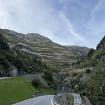
Overview
About this route
Sustenpass Grimselpass Nufenenpass Sankt Gottardpass
- -:--
- Duration
- 158.9 km
- Distance
- 3,905 m
- Ascent
- 3,702 m
- Descent
- ---
- Avg. speed
- 2,254 m
- Max. altitude

Route quality
Waytypes & surfaces along the route
Waytypes
Track
19.1 km
(12 %)
Quiet road
7.9 km
(5 %)
Surfaces
Paved
139.9 km
(88 %)
Unpaved
12.7 km
(8 %)
Asphalt
136.7 km
(86 %)
Unpaved (undefined)
4.8 km
(3 %)
Continue with Bikemap
Use, edit, or download this cycling route
You would like to ride Andermatt 3 or customize it for your own trip? Here is what you can do with this Bikemap route:
Free features
- Save this route as favorite or in collections
- Copy & plan your own version of this route
- Split it into stages to create a multi-day tour
- Sync your route with Garmin or Wahoo
Premium features
Free trial for 3 days, or one-time payment. More about Bikemap Premium.
- Navigate this route on iOS & Android
- Export a GPX / KML file of this route
- Create your custom printout (try it for free)
- Download this route for offline navigation
Discover more Premium features.
Get Bikemap PremiumFrom our community
Other popular routes starting in Andermatt
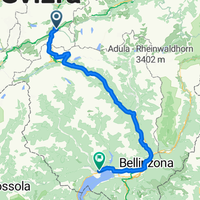 Von Andermatt bis Locarno
- Distance
- 115.9 km
- Ascent
- 2,182 m
- Descent
- 3,407 m
- Location
- Andermatt, Canton of Uri, Switzerland
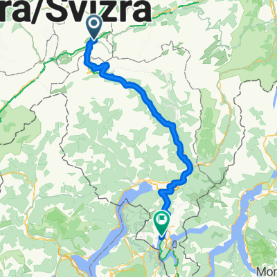
 VR01 Furkapass Belvedere-Brig.kml - VR01 Furkapass Belvedere-Brig.kml_VR01 Furkapass Belvedere-Brig
- Distance
- 60.1 km
- Ascent
- 852 m
- Descent
- 2,409 m
- Location
- Andermatt, Canton of Uri, Switzerland
 Rheinradtour Teil1/Etappe1
- Distance
- 51.4 km
- Ascent
- 620 m
- Descent
- 1,924 m
- Location
- Andermatt, Canton of Uri, Switzerland
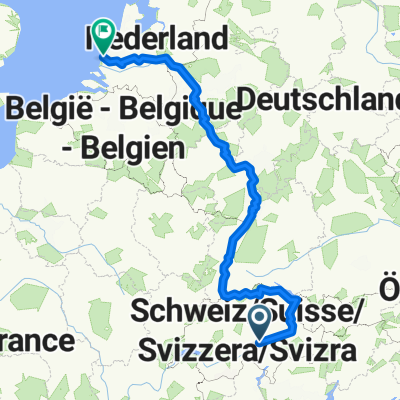
 rhein von oberalppass nach hoek van holland
- Distance
- 1,427.3 km
- Ascent
- 146 m
- Descent
- 2,169 m
- Location
- Andermatt, Canton of Uri, Switzerland
 Bellinzona - Vizzola Ticino
- Distance
- 130.7 km
- Ascent
- 2,639 m
- Descent
- 3,799 m
- Location
- Andermatt, Canton of Uri, Switzerland
 Via Alpsu, Rueras to Klosterweg, Ilanz
- Distance
- 53.1 km
- Ascent
- 526 m
- Descent
- 1,579 m
- Location
- Andermatt, Canton of Uri, Switzerland
 NL The Rhine Cycle Route
- Distance
- 1,352.1 km
- Ascent
- 88 m
- Descent
- 1,523 m
- Location
- Andermatt, Canton of Uri, Switzerland
 Furkastrasse, Realp nach Ritystrasse, Brigerbad
- Distance
- 70.6 km
- Ascent
- 558 m
- Descent
- 2,246 m
- Location
- Andermatt, Canton of Uri, Switzerland
Open it in the app