

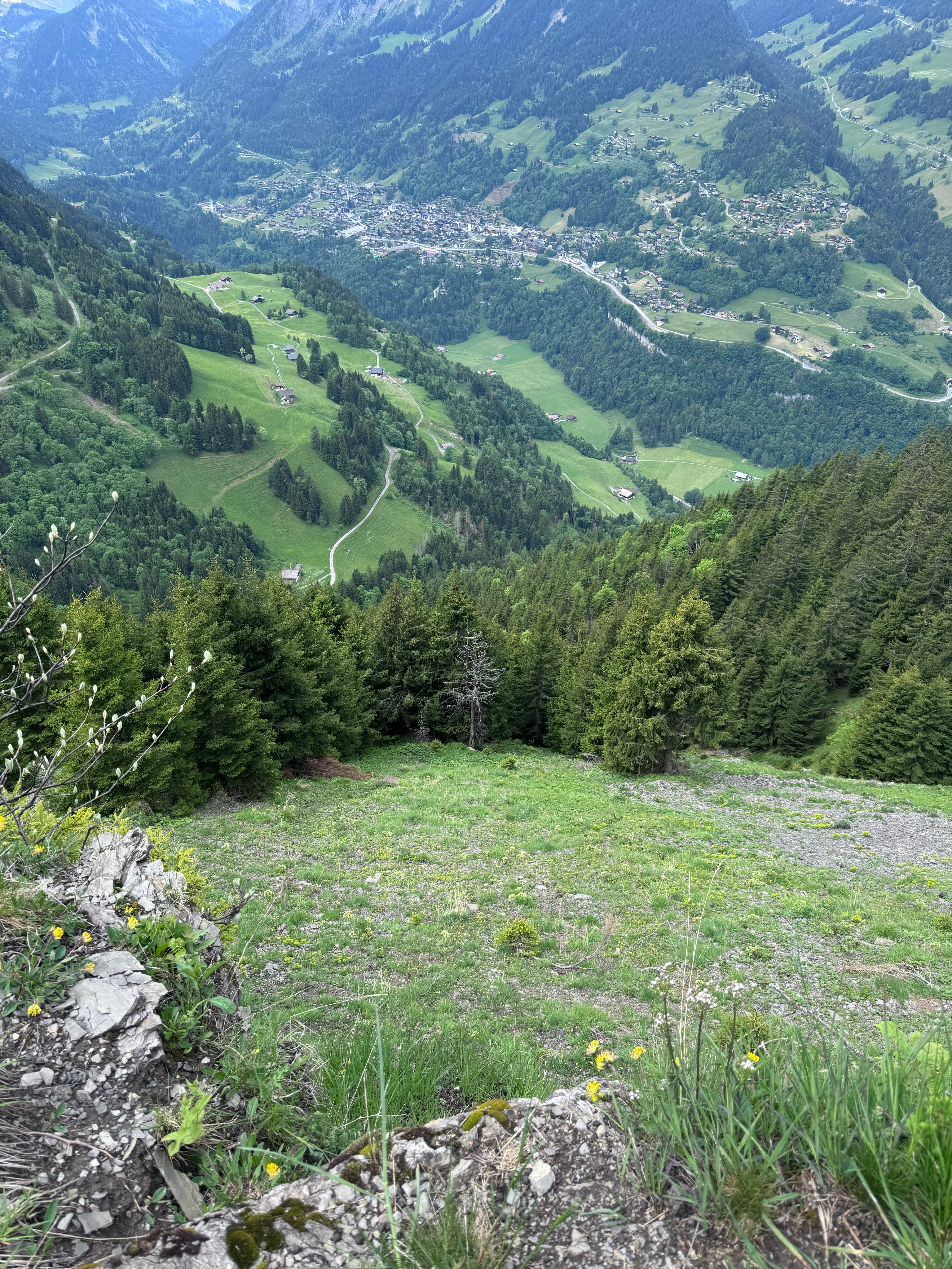
29.Aug.2012 Chalet Onu-Trailabfahrt nach Champery-Lac de Antème-Champery-Chalet Onu
A cycling route starting in Champéry, Valais, Switzerland.
Overview
About this route
2035 meters of elevation great trail descent to Champery steep ascent to Lac (at the top pushing and carrying sections!) Caution - do not skip the detour! But worth it (in the heat, take a towel and stand under the waterfall!) At the top there's a managed hut (overnight stay possible) Great, endless long trail descent to Champery; caution, very dangerous (right along the precipice); partly to push.
Only for very experienced riders!!!
- -:--
- Duration
- 42.4 km
- Distance
- 1,889 m
- Ascent
- 1,900 m
- Descent
- ---
- Avg. speed
- ---
- Max. altitude
Continue with Bikemap
Use, edit, or download this cycling route
You would like to ride 29.Aug.2012 Chalet Onu-Trailabfahrt nach Champery-Lac de Antème-Champery-Chalet Onu or customize it for your own trip? Here is what you can do with this Bikemap route:
Free features
- Save this route as favorite or in collections
- Copy & plan your own version of this route
- Sync your route with Garmin or Wahoo
Premium features
Free trial for 3 days, or one-time payment. More about Bikemap Premium.
- Navigate this route on iOS & Android
- Export a GPX / KML file of this route
- Create your custom printout (try it for free)
- Download this route for offline navigation
Discover more Premium features.
Get Bikemap PremiumFrom our community
Other popular routes starting in Champéry
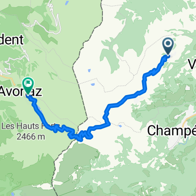
 Le Tour du Midi
- Distance
- 48.1 km
- Ascent
- 3,720 m
- Descent
- 3,371 m
- Location
- Champéry, Valais, Switzerland
 Val-d'Illiez à Chemin de Vai l'Otau, Troistorrents
- Distance
- 31.4 km
- Ascent
- 899 m
- Descent
- 1,894 m
- Location
- Champéry, Valais, Switzerland
 Col de Cou
- Distance
- 17.3 km
- Ascent
- 483 m
- Descent
- 1,374 m
- Location
- Champéry, Valais, Switzerland
 Critérium du Dauphiné 2013 Stage 1
- Distance
- 124.9 km
- Ascent
- 2,262 m
- Descent
- 2,239 m
- Location
- Champéry, Valais, Switzerland
 Champery - Champery
- Distance
- 124.4 km
- Ascent
- 2,244 m
- Descent
- 2,249 m
- Location
- Champéry, Valais, Switzerland
 Rue Gamma, Champoussin nach Rue des Traîneaux, Morzine
- Distance
- 14.5 km
- Ascent
- 861 m
- Descent
- 661 m
- Location
- Champéry, Valais, Switzerland
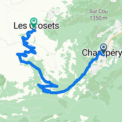 Route de la Fin, Champéry to Route des Crosets, Les Crosets
- Distance
- 11.6 km
- Ascent
- 829 m
- Descent
- 188 m
- Location
- Champéry, Valais, Switzerland
 04/06 | Hotel National a Royal Savoy
- Distance
- 74 km
- Ascent
- 770 m
- Descent
- 1,418 m
- Location
- Champéry, Valais, Switzerland
Open it in the app