Chicago - Milwaukee Retour
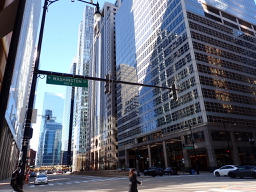
A cycling route starting in Chicago, Illinois, United States.
Overview
About this route
This route tries to avoid streets wherever possible: 95% Bikepaths.
I would reccoment this route to everyone who dislikes acclivity and traffic.
- -:--
- Duration
- 414.3 km
- Distance
- 324 m
- Ascent
- 330 m
- Descent
- ---
- Avg. speed
- ---
- Max. altitude
Route quality
Waytypes & surfaces along the route
Waytypes
Cycleway
161.6 km
(39 %)
Quiet road
87 km
(21 %)
Surfaces
Paved
186.4 km
(45 %)
Unpaved
53.9 km
(13 %)
Asphalt
103.6 km
(25 %)
Paved (undefined)
70.4 km
(17 %)
Route highlights
Points of interest along the route
Point of interest after 151 km
From here you can bike a long way through the park
Point of interest after 160.5 km
From here to South you can bike very near the lake until W College Av.
Point of interest after 204.2 km
Oak Leaf Trail here!
Point of interest after 206 km
Oak Leaf Trail here!
Continue with Bikemap
Use, edit, or download this cycling route
You would like to ride Chicago - Milwaukee Retour or customize it for your own trip? Here is what you can do with this Bikemap route:
Free features
- Save this route as favorite or in collections
- Copy & plan your own version of this route
- Split it into stages to create a multi-day tour
- Sync your route with Garmin or Wahoo
Premium features
Free trial for 3 days, or one-time payment. More about Bikemap Premium.
- Navigate this route on iOS & Android
- Export a GPX / KML file of this route
- Create your custom printout (try it for free)
- Download this route for offline navigation
Discover more Premium features.
Get Bikemap PremiumFrom our community
Other popular routes starting in Chicago
 Chicago to Missoula: Badlands, Mt Rushmore & Crazy Horse, Devil’s Tower, Yellowstone, Missoula
- Distance
- 3,592.7 km
- Ascent
- 32,635 m
- Descent
- 31,839 m
- Location
- Chicago, Illinois, United States
 Ride Chicago Loop Fullerton Beach
- Distance
- 21.6 km
- Ascent
- 130 m
- Descent
- 130 m
- Location
- Chicago, Illinois, United States
 Chigravel
- Distance
- 9.5 km
- Ascent
- 38 m
- Descent
- 38 m
- Location
- Chicago, Illinois, United States
 133–199 S Michigan Ave, Chicago to 1433 W Cullerton St, Chicago
- Distance
- 6.3 km
- Ascent
- 146 m
- Descent
- 149 m
- Location
- Chicago, Illinois, United States
 Roll N Peace
- Distance
- 13.8 km
- Ascent
- 68 m
- Descent
- 67 m
- Location
- Chicago, Illinois, United States
 West Side
- Distance
- 10.5 km
- Ascent
- 8 m
- Descent
- 8 m
- Location
- Chicago, Illinois, United States
 Chicago to Oak Lawn
- Distance
- 32 km
- Ascent
- 163 m
- Descent
- 154 m
- Location
- Chicago, Illinois, United States
 West Madison Street 2423, Chicago to West Madison Street 2426, Chicago
- Distance
- 4.9 km
- Ascent
- 0 m
- Descent
- 0 m
- Location
- Chicago, Illinois, United States
Open it in the app


