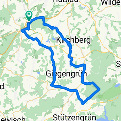
Rundtour 2
A cycling route starting in Hirschfeld, Saxony, Germany.
Overview
About this route
schöne Rundtour, mit Anteil an Straße im Bereich von Lichtentanne
in Zwickau über den Radweg am Hauptfriedhof-Pölbitz und dann auf dem Muldenradweg entlang, mit Abstecher ins Zentrum von Zwickau, Möglichkeiten der Besichtigung aller innerstädtischen Sehenswürdigkeiten, wieter durch das Parkgelände im Schwanenteich und dann durch Planitz, mit recht stetigem Anstieg
- -:--
- Duration
- 30.2 km
- Distance
- 173 m
- Ascent
- 173 m
- Descent
- ---
- Avg. speed
- ---
- Avg. speed
Continue with Bikemap
Use, edit, or download this cycling route
You would like to ride Rundtour 2 or customize it for your own trip? Here is what you can do with this Bikemap route:
Free features
- Save this route as favorite or in collections
- Copy & plan your own version of this route
- Sync your route with Garmin or Wahoo
Premium features
Free trial for 3 days, or one-time payment. More about Bikemap Premium.
- Navigate this route on iOS & Android
- Export a GPX / KML file of this route
- Create your custom printout (try it for free)
- Download this route for offline navigation
Discover more Premium features.
Get Bikemap PremiumFrom our community
Other popular routes starting in Hirschfeld
- Juchhöh
- Distance
- 30.5 km
- Ascent
- 449 m
- Descent
- 223 m
- Location
- Hirschfeld, Saxony, Germany
- Ebersbrunn-Hirschfeld
- Distance
- 14.3 km
- Ascent
- 195 m
- Descent
- 194 m
- Location
- Hirschfeld, Saxony, Germany
- Rundtour 2
- Distance
- 30.2 km
- Ascent
- 173 m
- Descent
- 173 m
- Location
- Hirschfeld, Saxony, Germany
- Pohlteichschänke über H und W
- Distance
- 11.3 km
- Ascent
- 144 m
- Descent
- 198 m
- Location
- Hirschfeld, Saxony, Germany
- 18-06-06 Tour Ebersbrunn Leipzig
- Distance
- 96.7 km
- Ascent
- 166 m
- Descent
- 451 m
- Location
- Hirschfeld, Saxony, Germany
- Pohlteichschänke
- Distance
- 8 km
- Ascent
- 119 m
- Descent
- 174 m
- Location
- Hirschfeld, Saxony, Germany
- Jogginrunde
- Distance
- 13.2 km
- Ascent
- 261 m
- Descent
- 261 m
- Location
- Hirschfeld, Saxony, Germany
- Lengenfelder Straße 55, Lichtentanne nach Reichenbacher Straße 243, Heinsdorfergrund
- Distance
- 6.2 km
- Ascent
- 22 m
- Descent
- 86 m
- Location
- Hirschfeld, Saxony, Germany
Open it in the app