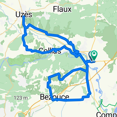
Pont du Gard
A cycling route starting in Remoulins, Languedoc-Roussillon-Midi-Pyrénées, France.
Overview
About this route
Kompromiss: Zur Verfügung stehende Zeit, Parkplatzmöglichkeit für Bus mit Veloanhänger, Schiff in Avignon stationiert.
- -:--
- Duration
- 15.2 km
- Distance
- 120 m
- Ascent
- 120 m
- Descent
- ---
- Avg. speed
- ---
- Avg. speed
Route quality
Waytypes & surfaces along the route
Waytypes
Quiet road
7.1 km
(47 %)
Road
3.4 km
(22 %)
Surfaces
Paved
6 km
(40 %)
Unpaved
0.1 km
(<1 %)
Asphalt
5.8 km
(38 %)
Concrete
0.3 km
(2 %)
Continue with Bikemap
Use, edit, or download this cycling route
You would like to ride Pont du Gard or customize it for your own trip? Here is what you can do with this Bikemap route:
Free features
- Save this route as favorite or in collections
- Copy & plan your own version of this route
- Sync your route with Garmin or Wahoo
Premium features
Free trial for 3 days, or one-time payment. More about Bikemap Premium.
- Navigate this route on iOS & Android
- Export a GPX / KML file of this route
- Create your custom printout (try it for free)
- Download this route for offline navigation
Discover more Premium features.
Get Bikemap PremiumFrom our community
Other popular routes starting in Remoulins
- route 3 remoulins
- Distance
- 81.8 km
- Ascent
- 640 m
- Descent
- 640 m
- Location
- Remoulins, Languedoc-Roussillon-Midi-Pyrénées, France
- Provence 2004 1. Tag
- Distance
- 83.3 km
- Ascent
- 339 m
- Descent
- 237 m
- Location
- Remoulins, Languedoc-Roussillon-Midi-Pyrénées, France
- Route 2 Remoulins - Les Beaux
- Distance
- 91.5 km
- Ascent
- 444 m
- Descent
- 444 m
- Location
- Remoulins, Languedoc-Roussillon-Midi-Pyrénées, France
- Pont du Gard
- Distance
- 15.2 km
- Ascent
- 120 m
- Descent
- 120 m
- Location
- Remoulins, Languedoc-Roussillon-Midi-Pyrénées, France
- Fournès to Maussane-les-Alpilles
- Distance
- 44.5 km
- Ascent
- 176 m
- Descent
- 193 m
- Location
- Remoulins, Languedoc-Roussillon-Midi-Pyrénées, France
- Provence 2004 1. Tag CLONED FROM ROUTE 44038
- Distance
- 83.4 km
- Ascent
- 312 m
- Descent
- 184 m
- Location
- Remoulins, Languedoc-Roussillon-Midi-Pyrénées, France
- Fournès - Circle to Écluse de Vallabrègues
- Distance
- 49.8 km
- Ascent
- 211 m
- Descent
- 210 m
- Location
- Remoulins, Languedoc-Roussillon-Midi-Pyrénées, France
- remoulins 64
- Distance
- 64.1 km
- Ascent
- 513 m
- Descent
- 506 m
- Location
- Remoulins, Languedoc-Roussillon-Midi-Pyrénées, France
Open it in the app