1ère étape
- 50 km
- 176 m
- 197 m
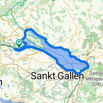
- Öhningen, Baden-Wurttemberg, Germany
A cycling route starting in Öhningen, Baden-Wurttemberg, Germany.
Overview
created this 16 years ago
Route quality
Quiet road
47.3 km
(24 %)
Path
21.7 km
(11 %)
Paved
185.5 km
(94 %)
Unpaved
5.9 km
(3 %)
Asphalt
183.5 km
(93 %)
Loose gravel
3.9 km
(2 %)
Continue with Bikemap
You would like to ride Bodensee Umrundung or customize it for your own trip? Here is what you can do with this Bikemap route:
Free trial for 3 days, or one-time payment. More about Bikemap Premium.
Discover more Premium features.
Get Bikemap PremiumFrom our community
Open it in the app