

Eifelroute mit 2 Anstiegen
A cycling route starting in Gerolstein, Rhineland-Palatinate, Germany.
Overview
About this route
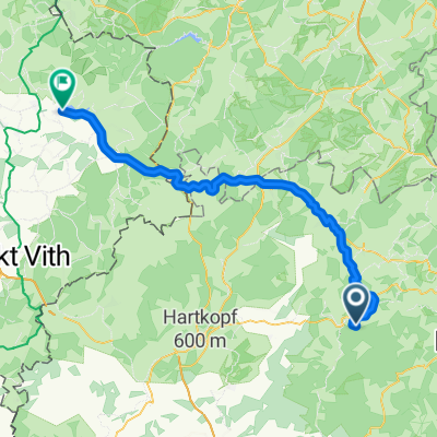
Route through the Eifel with two beautiful climbs! Start and finish at the Volksbank in Gerolstein!
- -:--
- Duration
- 59.3 km
- Distance
- 764 m
- Ascent
- 751 m
- Descent
- ---
- Avg. speed
- ---
- Max. altitude
Route quality
Waytypes & surfaces along the route
Waytypes
Road
15.4 km
(26 %)
Track
3.6 km
(6 %)
Surfaces
Paved
29.6 km
(50 %)
Asphalt
29.6 km
(50 %)
Undefined
29.6 km
(50 %)
Continue with Bikemap
Use, edit, or download this cycling route
You would like to ride Eifelroute mit 2 Anstiegen or customize it for your own trip? Here is what you can do with this Bikemap route:
Free features
- Save this route as favorite or in collections
- Copy & plan your own version of this route
- Sync your route with Garmin or Wahoo
Premium features
Free trial for 3 days, or one-time payment. More about Bikemap Premium.
- Navigate this route on iOS & Android
- Export a GPX / KML file of this route
- Create your custom printout (try it for free)
- Download this route for offline navigation
Discover more Premium features.
Get Bikemap PremiumFrom our community
Other popular routes starting in Gerolstein
 Gerolstein - Himmerod - Gerolstein
- Distance
- 86.5 km
- Ascent
- 836 m
- Descent
- 827 m
- Location
- Gerolstein, Rhineland-Palatinate, Germany
 Gerolstein Gees-Berlingen-Roth
- Distance
- 27.5 km
- Ascent
- 625 m
- Descent
- 657 m
- Location
- Gerolstein, Rhineland-Palatinate, Germany
 Zur Büschkapelle, Gerolstein nach Seestraße, Bütgenbach
- Distance
- 57.6 km
- Ascent
- 701 m
- Descent
- 573 m
- Location
- Gerolstein, Rhineland-Palatinate, Germany
 1. Etappe Eifeltour - Gerolstein-Bitburg - 40km
- Distance
- 38.4 km
- Ascent
- 567 m
- Descent
- 598 m
- Location
- Gerolstein, Rhineland-Palatinate, Germany
 Gerolstein - Trier Etappe 3 BC
- Distance
- 80 km
- Ascent
- 1,618 m
- Descent
- 1,934 m
- Location
- Gerolstein, Rhineland-Palatinate, Germany
 Mit dem Fahrrad über alte Bahntrassen in der Eifel
- Distance
- 26 km
- Ascent
- 263 m
- Descent
- 342 m
- Location
- Gerolstein, Rhineland-Palatinate, Germany
 Salmwald-Rundfahrt
- Distance
- 34.8 km
- Ascent
- 620 m
- Descent
- 617 m
- Location
- Gerolstein, Rhineland-Palatinate, Germany
 Gerolstein Pelm Berlingen HinterweilerNeunkirchen
- Distance
- 14.5 km
- Ascent
- 284 m
- Descent
- 197 m
- Location
- Gerolstein, Rhineland-Palatinate, Germany
Open it in the app