Callosa-Safari-Relleu-Tudons
A cycling route starting in Callosa d'En SarriĆ , Valencia, Spain.
Overview
About this route
- -:--
- Duration
- 120.1 km
- Distance
- 5,100 m
- Ascent
- 4,765 m
- Descent
- ---
- Avg. speed
- 1,046 m
- Max. altitude
Route quality
Waytypes & surfaces along the route
Waytypes
Track
3.6 km
(3 %)
Quiet road
1.2 km
(1 %)
Surfaces
Paved
48.1 km
(40 %)
Asphalt
45.7 km
(38 %)
Paved (undefined)
2.4 km
(2 %)
Undefined
72.1 km
(60 %)
Continue with Bikemap
Use, edit, or download this cycling route
You would like to ride Callosa-Safari-Relleu-Tudons or customize it for your own trip? Here is what you can do with this Bikemap route:
Free features
- Save this route as favorite or in collections
- Copy & plan your own version of this route
- Split it into stages to create a multi-day tour
- Sync your route with Garmin or Wahoo
Premium features
Free trial for 3 days, or one-time payment. More about Bikemap Premium.
- Navigate this route on iOS & Android
- Export a GPX / KML file of this route
- Create your custom printout (try it for free)
- Download this route for offline navigation
Discover more Premium features.
Get Bikemap PremiumFrom our community
Other popular routes starting in Callosa d'En SarriĆ
Callosa-Safari-Relleu-Tudons- Distance
- 120.1 km
- Ascent
- 5,100 m
- Descent
- 4,765 m
- Location
- Callosa d'En SarriĆ , Valencia, Spain
Col de Rates- Distance
- 65 km
- Ascent
- 1,071 m
- Descent
- 1,071 m
- Location
- Callosa d'En SarriĆ , Valencia, Spain
Aitana Tour Gran Fondo- Distance
- 155.6 km
- Ascent
- 4,457 m
- Descent
- 4,431 m
- Location
- Callosa d'En SarriĆ , Valencia, Spain
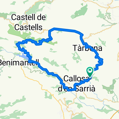
20180806 Mauri contador 2018- Distance
- 124.8 km
- Ascent
- 2,039 m
- Descent
- 2,039 m
- Location
- Callosa d'En SarriĆ , Valencia, Spain
AITA TOUR MEDIO FONDO- Distance
- 112.1 km
- Ascent
- 2,973 m
- Descent
- 2,954 m
- Location
- Callosa d'En SarriĆ , Valencia, Spain
AITANA TOUR TRANSICIĆN VALL EBO- Distance
- 132.6 km
- Ascent
- 3,395 m
- Descent
- 3,393 m
- Location
- Callosa d'En SarriĆ , Valencia, Spain
Eixida Invernal 2011- Distance
- 44 km
- Ascent
- 1,198 m
- Descent
- 1,198 m
- Location
- Callosa d'En SarriĆ , Valencia, Spain
Route 18: Callosa-Tarbena-Alto Somo-Castell-Parcent- Distance
- 45.3 km
- Ascent
- 904 m
- Descent
- 957 m
- Location
- Callosa d'En SarriĆ , Valencia, Spain
Open it in the app

