samstagsrunde
- 31.5 km
- 517 m
- 520 m
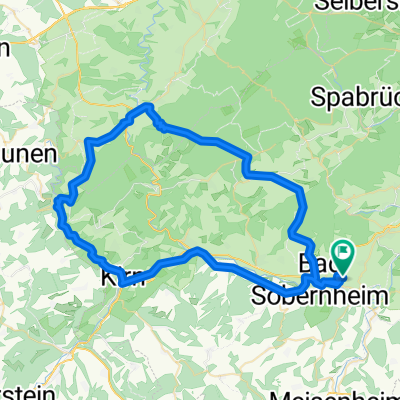
- Staudernheim, Rhineland-Palatinate, Germany
A cycling route starting in Staudernheim, Rhineland-Palatinate, Germany.
Overview
A route along the river Nahe from Bad Sobernheim to Bingen on the river Rhine. Easy route, nice landscape, lots of direction signs make it easy to follow directions.
created this 13 years ago
Route quality
Track
16 km
(36 %)
Path
8 km
(18 %)
Paved
33.7 km
(76 %)
Unpaved
6.2 km
(14 %)
Asphalt
32.4 km
(73 %)
Gravel
4 km
(9 %)
Continue with Bikemap
You would like to ride Bad Sobermheim - Bingen flw Nahe or customize it for your own trip? Here is what you can do with this Bikemap route:
Free trial for 3 days, or one-time payment. More about Bikemap Premium.
Discover more Premium features.
Get Bikemap PremiumFrom our community
Open it in the app