

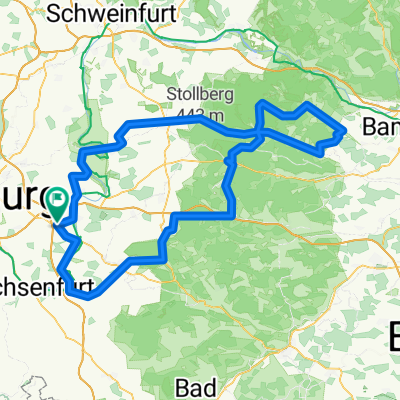
BB-Tour 120km 2012
A cycling route starting in Buchbrunn, Bavaria, Germany.
Overview
About this route
this is roughly how the 120 km route goes The 160 km is extended by a 40 km loop from/to Untersteinbach.
- -:--
- Duration
- 119.4 km
- Distance
- 812 m
- Ascent
- 812 m
- Descent
- ---
- Avg. speed
- ---
- Max. altitude

Route quality
Waytypes & surfaces along the route
Waytypes
Road
50.1 km
(42 %)
Quiet road
4.8 km
(4 %)
Surfaces
Paved
57.3 km
(48 %)
Unpaved
1.2 km
(1 %)
Asphalt
57.3 km
(48 %)
Ground
1.2 km
(1 %)
Undefined
60.9 km
(51 %)
Continue with Bikemap
Use, edit, or download this cycling route
You would like to ride BB-Tour 120km 2012 or customize it for your own trip? Here is what you can do with this Bikemap route:
Free features
- Save this route as favorite or in collections
- Copy & plan your own version of this route
- Split it into stages to create a multi-day tour
- Sync your route with Garmin or Wahoo
Premium features
Free trial for 3 days, or one-time payment. More about Bikemap Premium.
- Navigate this route on iOS & Android
- Export a GPX / KML file of this route
- Create your custom printout (try it for free)
- Download this route for offline navigation
Discover more Premium features.
Get Bikemap PremiumFrom our community
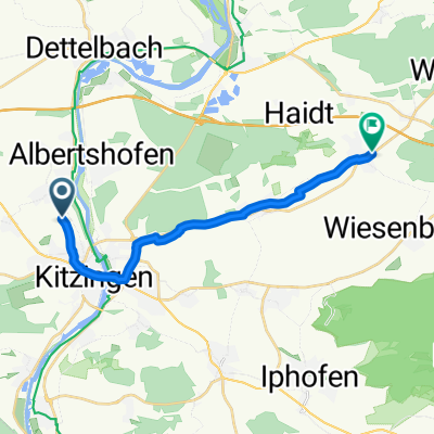
Other popular routes starting in Buchbrunn
 BB-Tour 120km 2012
- Distance
- 119.4 km
- Ascent
- 812 m
- Descent
- 812 m
- Location
- Buchbrunn, Bavaria, Germany
 Bocksbeutel 4
- Distance
- 160 km
- Ascent
- 1,035 m
- Descent
- 1,035 m
- Location
- Buchbrunn, Bavaria, Germany
 Kitzingen Boxbeuteltour 84
- Distance
- 84.6 km
- Ascent
- 513 m
- Descent
- 513 m
- Location
- Buchbrunn, Bavaria, Germany
 GWF Familientour
- Distance
- 21.3 km
- Ascent
- 167 m
- Descent
- 167 m
- Location
- Buchbrunn, Bavaria, Germany
 Mainstockheim Estenfeld
- Distance
- 15.9 km
- Ascent
- 227 m
- Descent
- 186 m
- Location
- Buchbrunn, Bavaria, Germany
 BBTour 2013 Tour 4
- Distance
- 155.4 km
- Ascent
- 707 m
- Descent
- 705 m
- Location
- Buchbrunn, Bavaria, Germany
 Einfache Fahrt in Kleinlangheim
- Distance
- 13.9 km
- Ascent
- 62 m
- Descent
- 65 m
- Location
- Buchbrunn, Bavaria, Germany
 Bocksbeuteltour 46 km
- Distance
- 46.2 km
- Ascent
- 238 m
- Descent
- 238 m
- Location
- Buchbrunn, Bavaria, Germany
Open it in the app