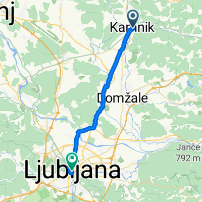
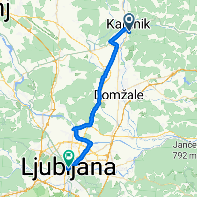
Kamnik-Menina planina
A cycling route starting in Kamnik, Kamnik, Slovenia.
Overview
About this route
- -:--
- Duration
- 60 km
- Distance
- 1,325 m
- Ascent
- 1,325 m
- Descent
- ---
- Avg. speed
- ---
- Max. altitude
Continue with Bikemap
Use, edit, or download this cycling route
You would like to ride Kamnik-Menina planina or customize it for your own trip? Here is what you can do with this Bikemap route:
Free features
- Save this route as favorite or in collections
- Copy & plan your own version of this route
- Sync your route with Garmin or Wahoo
Premium features
Free trial for 3 days, or one-time payment. More about Bikemap Premium.
- Navigate this route on iOS & Android
- Export a GPX / KML file of this route
- Create your custom printout (try it for free)
- Download this route for offline navigation
Discover more Premium features.
Get Bikemap PremiumFrom our community
Other popular routes starting in Kamnik
Kamnik to Ljubliana- Distance
- 24.8 km
- Ascent
- 96 m
- Descent
- 183 m
- Location
- Kamnik, Kamnik, Slovenia
Na Konja- Distance
- 27.4 km
- Ascent
- 1,151 m
- Descent
- 197 m
- Location
- Kamnik, Kamnik, Slovenia
Runda by:se-ma- Distance
- 68.3 km
- Ascent
- 608 m
- Descent
- 608 m
- Location
- Kamnik, Kamnik, Slovenia
od Blažiča do parkirišča za Malo Planino- Distance
- 16.4 km
- Ascent
- 845 m
- Descent
- 68 m
- Location
- Kamnik, Kamnik, Slovenia
Po Sloveniji 2009, 2. etapa Kamnik - Ljubljana, 143 km- Distance
- 142.3 km
- Ascent
- 1,420 m
- Descent
- 1,468 m
- Location
- Kamnik, Kamnik, Slovenia
Kamnik-Šenturška G.- Mengeško polje-Palovče- Distance
- 39.8 km
- Ascent
- 689 m
- Descent
- 689 m
- Location
- Kamnik, Kamnik, Slovenia
Kamnik - Kamniška Bistrica- Distance
- 15 km
- Ascent
- 373 m
- Descent
- 126 m
- Location
- Kamnik, Kamnik, Slovenia
Kamnik-Sv. Lenart-Kamnik- Distance
- 20.9 km
- Ascent
- 502 m
- Descent
- 500 m
- Location
- Kamnik, Kamnik, Slovenia
Open it in the app


