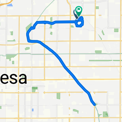
East Jaeger Street 2235, Mesa to East Jaeger Street 2235, Mesa
- 31.3 km
- 41 m
- 16 m
- Mesa, Arizona, United States
A cycling route starting in Mesa, Arizona, United States.
Overview
Ride out to Saguaro Lake via Bush Highway, following Salt River; return on Beeline Highway. While there are large shoulders on highways at nearly all parts, be aware that Bush Highway is used heavily by boaters, and the Beeline is a 4-lane mostly-divided highway with very heavy traffic at times. Alternatives: Ride McKellips to Ellsworth and take the Usery Pass road, Take McDowell instead of McKellips, Use Gilbert Rd as a shortcut (places not rider friendly). Note that most of the route is through park/forest/reservation, so services (restrooms, water stops, etc) are limited. On the Beeline, a good stopping point is at the Fort McDowell Rd junction, or at Shea Blvd turn to Fountain Hills.
created this 13 years ago
Continue with Bikemap
You would like to ride Bush Beeline Loop or customize it for your own trip? Here is what you can do with this Bikemap route:
Free trial for 3 days, or one-time payment. More about Bikemap Premium.
Discover more Premium features.
Get Bikemap PremiumFrom our community
Open it in the app