Lauchhammer-Grünewalder Lauch und Umgebung-Lauchhammer
A cycling route starting in Lauchhammer, Brandenburg, Germany.
Overview
About this route
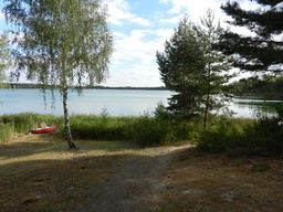
Dies ist eine kleine Tour von Lauchhammer Mitte zum Grünewalder Lauch und Umgebung. Erster Zwischenstop ist ein kleiner Tümpel bei Staupitz, welcher bei Google ein wenig schöner aussieht als im Original. Einen direkten und guten Weg gibts es dahin allerdings nicht.
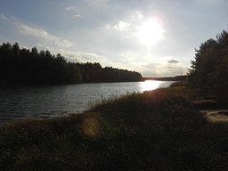
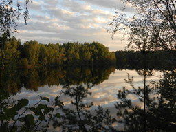
Dann geht es direkt weiter zum Grünewalder Lauch. Eine Runde herum und einen Abstecher nach Gorden-Staupitz.
Von Gorden gehts dann Richtung Lauchhammer zurück. Nochmal am Grünewalder Lauch, am Sportplatz in Staupitz, Grünewalder Linse und dem Großen Woobergsee vorbei.
- -:--
- Duration
- 42.7 km
- Distance
- 162 m
- Ascent
- 160 m
- Descent
- ---
- Avg. speed
- ---
- Avg. speed
Route highlights
Points of interest along the route

Photo after 10.9 km
Tümpel bei Staupitz

Photo after 11 km
Google Maps- Bild vom Tümpel

Photo after 15.3 km
Grünewalder Lauch, Blick Richtung Grünewald

Photo after 24.1 km
Gorden-Pferdekoppel

Photo after 26.7 km

Photo after 34.1 km
Grünewalder Linse
Continue with Bikemap
Use, edit, or download this cycling route
You would like to ride Lauchhammer-Grünewalder Lauch und Umgebung-Lauchhammer or customize it for your own trip? Here is what you can do with this Bikemap route:
Free features
- Save this route as favorite or in collections
- Copy & plan your own version of this route
- Sync your route with Garmin or Wahoo
Premium features
Free trial for 3 days, or one-time payment. More about Bikemap Premium.
- Navigate this route on iOS & Android
- Export a GPX / KML file of this route
- Create your custom printout (try it for free)
- Download this route for offline navigation
Discover more Premium features.
Get Bikemap PremiumFrom our community
Other popular routes starting in Lauchhammer
 Lauchhammer-Ostsee
- Distance
- 403.9 km
- Ascent
- 683 m
- Descent
- 728 m
- Location
- Lauchhammer, Brandenburg, Germany
 Radtour un den Loben
- Distance
- 35.2 km
- Ascent
- 118 m
- Descent
- 119 m
- Location
- Lauchhammer, Brandenburg, Germany
 LH-Plessa-LH MTB_Runde
- Distance
- 31.6 km
- Ascent
- 79 m
- Descent
- 80 m
- Location
- Lauchhammer, Brandenburg, Germany
 Starke Straße 25, Lauchhammer nach Starke Straße 29, Lauchhammer
- Distance
- 11.3 km
- Ascent
- 9 m
- Descent
- 9 m
- Location
- Lauchhammer, Brandenburg, Germany
 "Höhenmeterfresserrunde" LH-Mitte - Schipkau - Kostebrau - LH
- Distance
- 37.7 km
- Ascent
- 246 m
- Descent
- 244 m
- Location
- Lauchhammer, Brandenburg, Germany
 Route zu Grünewalder Lauch
- Distance
- 21 km
- Ascent
- 85 m
- Descent
- 71 m
- Location
- Lauchhammer, Brandenburg, Germany
 Kippenrennen 2016 in Lauchhammer
- Distance
- 40.4 km
- Ascent
- 186 m
- Descent
- 184 m
- Location
- Lauchhammer, Brandenburg, Germany
 Natur Pur
- Distance
- 40.7 km
- Ascent
- 101 m
- Descent
- 99 m
- Location
- Lauchhammer, Brandenburg, Germany
Open it in the app


