

Budai hegyek túra 2012
A cycling route starting in Budapest XV. kerület, Budapest, Hungary.
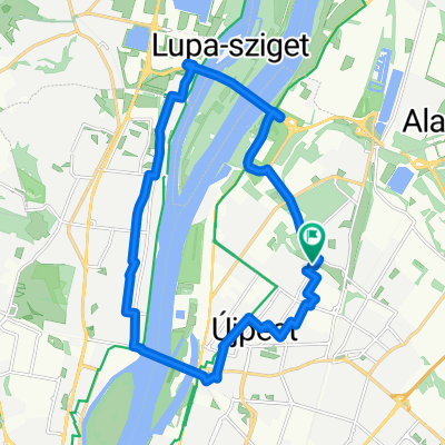
Overview
About this route
You have to ride a lot in the city.. Traffic is quite heavy in places, and road conditions vary. Some climbs are very tough, seemingly with gradients of 10-15-20-25% on some (not really signposted).. Riding this route offers a beautiful panoramic view of the entire city (mainly Buda). It's worth spending time on the individual summits and enjoying the view :)
- -:--
- Duration
- 82.6 km
- Distance
- 913 m
- Ascent
- 915 m
- Descent
- ---
- Avg. speed
- ---
- Max. altitude

Route quality
Waytypes & surfaces along the route
Waytypes
Quiet road
24 km
(29 %)
Road
17.3 km
(21 %)
Surfaces
Paved
71 km
(86 %)
Unpaved
0.8 km
(1 %)
Asphalt
71 km
(86 %)
Gravel
0.8 km
(1 %)
Undefined
10.7 km
(13 %)
Route highlights
Points of interest along the route
Point of interest after 9.8 km
Margit-sziget
Point of interest after 23.2 km
Gellért-hegy (Citadella) 235m
Point of interest after 27.9 km
Sas-hegy, 266m
Point of interest after 39.6 km
1. eltévedés, erre nem kell jönni!!!
Point of interest after 40.6 km
Csillebérc
Point of interest after 43.6 km
Szechenyi-hegy
Point of interest after 44.8 km
Normafa
Point of interest after 54.8 km
János-hegy, (Erzsébet-kilátó) 527m
Point of interest after 64.9 km
2. eltévedés... Nem találtam az utat a Hármashatár-hegy felé.. aztán kifutottam az időből..
Point of interest after 68.1 km
Mátyás-hegy
Continue with Bikemap
Use, edit, or download this cycling route
You would like to ride Budai hegyek túra 2012 or customize it for your own trip? Here is what you can do with this Bikemap route:
Free features
- Save this route as favorite or in collections
- Copy & plan your own version of this route
- Split it into stages to create a multi-day tour
- Sync your route with Garmin or Wahoo
Premium features
Free trial for 3 days, or one-time payment. More about Bikemap Premium.
- Navigate this route on iOS & Android
- Export a GPX / KML file of this route
- Create your custom printout (try it for free)
- Download this route for offline navigation
Discover more Premium features.
Get Bikemap PremiumFrom our community
Other popular routes starting in Budapest XV. kerület
 BT20 DunapartY tekergés
- Distance
- 25.3 km
- Ascent
- 46 m
- Descent
- 47 m
- Location
- Budapest XV. kerület, Budapest, Hungary
 Solymári edzőkör 2014
- Distance
- 52.9 km
- Ascent
- 250 m
- Descent
- 249 m
- Location
- Budapest XV. kerület, Budapest, Hungary
 Kilátó körút: Hárshegy - Jánoshegy
- Distance
- 61.1 km
- Ascent
- 6,160 m
- Descent
- 6,160 m
- Location
- Budapest XV. kerület, Budapest, Hungary
 Börzsönyi barangolás 2012
- Distance
- 121.3 km
- Ascent
- 552 m
- Descent
- 554 m
- Location
- Budapest XV. kerület, Budapest, Hungary
 Budapest-Balatonkenese
- Distance
- 119.2 km
- Ascent
- 368 m
- Descent
- 377 m
- Location
- Budapest XV. kerület, Budapest, Hungary
 Kisoroszi kiruccanás 2012
- Distance
- 84.4 km
- Ascent
- 78 m
- Descent
- 79 m
- Location
- Budapest XV. kerület, Budapest, Hungary
 Mátra 2011.07.31. Kékestető
- Distance
- 109.5 km
- Ascent
- 1,205 m
- Descent
- 309 m
- Location
- Budapest XV. kerület, Budapest, Hungary
 megyeri-kör
- Distance
- 18.6 km
- Ascent
- 47 m
- Descent
- 45 m
- Location
- Budapest XV. kerület, Budapest, Hungary
Open it in the app