- 53.6 km
- 623 m
- 625 m
- Oberndorf bei Salzburg, Salzburg, Austria
Rakousko 2012-15.den-28.7.So
A cycling route starting in Oberndorf bei Salzburg, Salzburg, Austria.
Overview
About this route
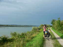
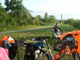
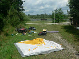
Still along the river - over the bridge into Germany - Tittmoning - further along B20 road - Moos - Hirschreit - Ranharting - Knappen - Nonnreit - Pritzl - viewpoint on the Salzach - Auberg - Moosbrunn - Castle at Burghausen - across the river back into Austria - Ach - slope - gas station and downpour - Duttendorf - viewpoint on the confluence Salzach+Inn - down to the river and at the tributary from Unterrothenbuch overnight stay.
- -:--
- Duration
- 46.7 km
- Distance
- 205 m
- Ascent
- 246 m
- Descent
- ---
- Avg. speed
- ---
- Max. altitude
created this 13 years ago
Route quality
Waytypes & surfaces along the route
Waytypes
Cycleway
9.8 km
(21 %)
Track
7 km
(15 %)
Surfaces
Paved
31.3 km
(67 %)
Unpaved
5.6 km
(12 %)
Asphalt
23.8 km
(51 %)
Concrete
7 km
(15 %)
Route highlights
Points of interest along the route

Photo after 4.2 km
oprava

Photo after 5.1 km
Krásné odpočivadlo. možnost noclehu

Photo after 23.5 km
vyhlídka

Photo after 30.9 km
Burghausen

Photo after 42.2 km
Vyhlídka nad soutokem Innu a Salzachu

Photo after 45.7 km
Tauernská už podle Innu

Photo after 46.6 km
večeře a hygiena

Photo after 46.7 km
15. nocleh kousek za soutokem
Continue with Bikemap
Use, edit, or download this cycling route
You would like to ride Rakousko 2012-15.den-28.7.So or customize it for your own trip? Here is what you can do with this Bikemap route:
Free features
- Save this route as favorite or in collections
- Copy & plan your own version of this route
- Sync your route with Garmin or Wahoo
Premium features
Free trial for 3 days, or one-time payment. More about Bikemap Premium.
- Navigate this route on iOS & Android
- Export a GPX / KML file of this route
- Create your custom printout (try it for free)
- Download this route for offline navigation
Discover more Premium features.
Get Bikemap PremiumFrom our community
Other popular routes starting in Oberndorf bei Salzburg
- Route in Oberndorf bei Salzburg
- Von Laufen bis Anger
- 22.1 km
- 360 m
- 228 m
- Oberndorf bei Salzburg, Salzburg, Austria
- Staufenstraße nach Staufenstraße
- 15.6 km
- 177 m
- 177 m
- Oberndorf bei Salzburg, Salzburg, Austria
- Von Oberndorf um den Stierlinger Wald (Tour 16)
- 28.4 km
- 179 m
- 179 m
- Oberndorf bei Salzburg, Salzburg, Austria
- Brückenstraße, Oberndorf nach Niederranna, Hofkirchen im Mühlkreis
- 170.4 km
- 1,478 m
- 1,589 m
- Oberndorf bei Salzburg, Salzburg, Austria
- Rottmayrplatz, Laufen nach Trumerstraße, Obertrum am See
- 14.5 km
- 420 m
- 307 m
- Oberndorf bei Salzburg, Salzburg, Austria
- Rakousko 2012-15.den-28.7.So
- 46.7 km
- 205 m
- 246 m
- Oberndorf bei Salzburg, Salzburg, Austria
- Oberndorf - Passau
- 128.5 km
- 800 m
- 895 m
- Oberndorf bei Salzburg, Salzburg, Austria
Open it in the app


