

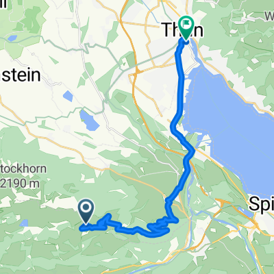
Diemtigtal
A cycling route starting in Erlenbach im Simmental, Canton of Bern, Switzerland.
Overview
About this route
Descent with a magnificent panorama of the Simmental
- -:--
- Duration
- 65.9 km
- Distance
- 1,259 m
- Ascent
- 1,322 m
- Descent
- ---
- Avg. speed
- ---
- Max. altitude
Route quality
Waytypes & surfaces along the route
Waytypes
Quiet road
11.9 km
(18 %)
Track
9.2 km
(14 %)
Surfaces
Paved
21.1 km
(32 %)
Unpaved
4 km
(6 %)
Asphalt
17.8 km
(27 %)
Paved (undefined)
3.3 km
(5 %)
Continue with Bikemap
Use, edit, or download this cycling route
You would like to ride Diemtigtal or customize it for your own trip? Here is what you can do with this Bikemap route:
Free features
- Save this route as favorite or in collections
- Copy & plan your own version of this route
- Sync your route with Garmin or Wahoo
Premium features
Free trial for 3 days, or one-time payment. More about Bikemap Premium.
- Navigate this route on iOS & Android
- Export a GPX / KML file of this route
- Create your custom printout (try it for free)
- Download this route for offline navigation
Discover more Premium features.
Get Bikemap PremiumFrom our community
Other popular routes starting in Erlenbach im Simmental
 43Jaunpass
- Distance
- 43.2 km
- Ascent
- 999 m
- Descent
- 857 m
- Location
- Erlenbach im Simmental, Canton of Bern, Switzerland
 Erlenbach - La Chaux-de-Fonds
- Distance
- 151.4 km
- Ascent
- 1,959 m
- Descent
- 1,616 m
- Location
- Erlenbach im Simmental, Canton of Bern, Switzerland
 Diemtigtal
- Distance
- 65.9 km
- Ascent
- 1,259 m
- Descent
- 1,322 m
- Location
- Erlenbach im Simmental, Canton of Bern, Switzerland
 Rossbärg von weisse Burg
- Distance
- 44.1 km
- Ascent
- 440 m
- Descent
- 43 m
- Location
- Erlenbach im Simmental, Canton of Bern, Switzerland
 Montée du Stockhorn par Oberstokensee
- Distance
- 24.9 km
- Ascent
- 1,279 m
- Descent
- 1,279 m
- Location
- Erlenbach im Simmental, Canton of Bern, Switzerland
 Rund um den Thuner See
- Distance
- 86.9 km
- Ascent
- 1,308 m
- Descent
- 1,310 m
- Location
- Erlenbach im Simmental, Canton of Bern, Switzerland
 Weissenburg - Wabern
- Distance
- 56.2 km
- Ascent
- 79 m
- Descent
- 350 m
- Location
- Erlenbach im Simmental, Canton of Bern, Switzerland
 thun stockhorn
- Distance
- 17.4 km
- Ascent
- 77 m
- Descent
- 1,071 m
- Location
- Erlenbach im Simmental, Canton of Bern, Switzerland
Open it in the app