
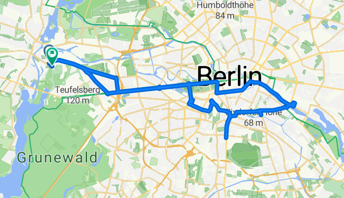
Ruhleben bis Ostbahnhof-Tempelhofer Flughafen-Ruhleben
A cycling route starting in Haselhorst, State of Berlin, Germany.
Overview
About this route
From Ruhleben to Ostbahnhof and back to Tempelhof Airport with a tour and the zoo with a stop at Cafe am neuen See.
- -:--
- Duration
- 45.7 km
- Distance
- 109 m
- Ascent
- 105 m
- Descent
- ---
- Avg. speed
- ---
- Max. altitude
Route quality
Waytypes & surfaces along the route
Waytypes
Cycleway
10.5 km
(23 %)
Quiet road
9.1 km
(20 %)
Surfaces
Paved
36.6 km
(80 %)
Asphalt
36.1 km
(79 %)
Concrete
0.5 km
(1 %)
Undefined
9.1 km
(20 %)
Continue with Bikemap
Use, edit, or download this cycling route
You would like to ride Ruhleben bis Ostbahnhof-Tempelhofer Flughafen-Ruhleben or customize it for your own trip? Here is what you can do with this Bikemap route:
Free features
- Save this route as favorite or in collections
- Copy & plan your own version of this route
- Sync your route with Garmin or Wahoo
Premium features
Free trial for 3 days, or one-time payment. More about Bikemap Premium.
- Navigate this route on iOS & Android
- Export a GPX / KML file of this route
- Create your custom printout (try it for free)
- Download this route for offline navigation
Discover more Premium features.
Get Bikemap PremiumFrom our community
Other popular routes starting in Haselhorst
 Heutige Radtour
- Distance
- 21.3 km
- Ascent
- 60 m
- Descent
- 61 m
- Location
- Haselhorst, State of Berlin, Germany
 Grunewald / Wannsee / Potsdam / Sacrow
- Distance
- 51.3 km
- Ascent
- 240 m
- Descent
- 243 m
- Location
- Haselhorst, State of Berlin, Germany
 Berlin nach Brieselang_2
- Distance
- 22 km
- Ascent
- 29 m
- Descent
- 32 m
- Location
- Haselhorst, State of Berlin, Germany
 Trainingsrunde Grunewald 70
- Distance
- 67.2 km
- Ascent
- 275 m
- Descent
- 276 m
- Location
- Haselhorst, State of Berlin, Germany
 Booshaus bis Hessenwinkel Kvgg Köpenick
- Distance
- 44.4 km
- Ascent
- 227 m
- Descent
- 221 m
- Location
- Haselhorst, State of Berlin, Germany
 Schloßpark und Regierungsviertel Spreeweg
- Distance
- 27 km
- Ascent
- 75 m
- Descent
- 75 m
- Location
- Haselhorst, State of Berlin, Germany
 Berlin Kuntzke 08
- Distance
- 39.8 km
- Ascent
- 56 m
- Descent
- 56 m
- Location
- Haselhorst, State of Berlin, Germany
 eine morgen Runde
- Distance
- 25.7 km
- Ascent
- 50 m
- Descent
- 51 m
- Location
- Haselhorst, State of Berlin, Germany
Open it in the app