

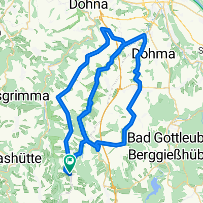
Osterzgebirge at its best
A cycling route starting in Liebstadt, Saxony, Germany.
Overview
About this route
Bahratal - Breitenau - Zinnwald - Moldava - Dubi - Krupka - Petrovice
Sehr harte Tour, aber wunderschön.
- -:--
- Duration
- 91.3 km
- Distance
- 1,608 m
- Ascent
- 1,536 m
- Descent
- ---
- Avg. speed
- 859 m
- Max. altitude

Route quality
Waytypes & surfaces along the route
Waytypes
Busy road
45.9 km
(50 %)
Road
27.2 km
(30 %)
Surfaces
Paved
52.8 km
(58 %)
Unpaved
4.1 km
(4 %)
Asphalt
50.8 km
(56 %)
Ground
2.4 km
(3 %)
Continue with Bikemap
Use, edit, or download this cycling route
You would like to ride Osterzgebirge at its best or customize it for your own trip? Here is what you can do with this Bikemap route:
Free features
- Save this route as favorite or in collections
- Copy & plan your own version of this route
- Split it into stages to create a multi-day tour
- Sync your route with Garmin or Wahoo
Premium features
Free trial for 3 days, or one-time payment. More about Bikemap Premium.
- Navigate this route on iOS & Android
- Export a GPX / KML file of this route
- Create your custom printout (try it for free)
- Download this route for offline navigation
Discover more Premium features.
Get Bikemap PremiumFrom our community
Other popular routes starting in Liebstadt
 Grenzlandstraße, Bad Gottleuba-Berggießhübel nach Grenzlandstraße 26E, Bad Gottleuba-Berggießhübel
- Distance
- 1.5 km
- Ascent
- 34 m
- Descent
- 61 m
- Location
- Liebstadt, Saxony, Germany
 Döbraer Straße 12, Liebstadt nach Döbraer Straße 12, Liebstadt
- Distance
- 54.7 km
- Ascent
- 236 m
- Descent
- 323 m
- Location
- Liebstadt, Saxony, Germany
 tour 211010 bärenstein - oberbärenburg
- Distance
- 44.3 km
- Ascent
- 882 m
- Descent
- 882 m
- Location
- Liebstadt, Saxony, Germany
 Osterzgebirge at its best
- Distance
- 91.3 km
- Ascent
- 1,608 m
- Descent
- 1,536 m
- Location
- Liebstadt, Saxony, Germany
 trebnitzgrund mückentürmchen
- Distance
- 48.6 km
- Ascent
- 585 m
- Descent
- 580 m
- Location
- Liebstadt, Saxony, Germany
 Mühlentag_Rück_flach
- Distance
- 22 km
- Ascent
- 376 m
- Descent
- 375 m
- Location
- Liebstadt, Saxony, Germany
 Bahratal Grenzübergang, Bad Gottleuba-Berggießhübel nach Am Markt 1/2, Pirna
- Distance
- 42.5 km
- Ascent
- 552 m
- Descent
- 872 m
- Location
- Liebstadt, Saxony, Germany
 Liebstadt-Mückentürmchen
- Distance
- 63.9 km
- Ascent
- 1,033 m
- Descent
- 1,042 m
- Location
- Liebstadt, Saxony, Germany
Open it in the app