

Moosinning-Schwaig und zurück
A cycling route starting in Moosinning, Bavaria, Germany.
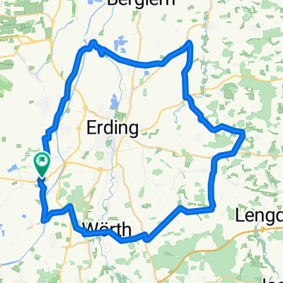
Overview
About this route
The route follows bike paths from Moosinning alongside the road towards Schwaig/airport. There, you ride as indicated through Schwaig and eventually come to a short gravel path that leads into a network of very quiet land consolidation roads. From there, you head back to Notzing and finally follow the familiar route back to Moosinning.
- -:--
- Duration
- 17.4 km
- Distance
- 30 m
- Ascent
- 31 m
- Descent
- ---
- Avg. speed
- 477 m
- Max. altitude

Route quality
Waytypes & surfaces along the route
Waytypes
Road
8 km
(46 %)
Quiet road
3.1 km
(18 %)
Surfaces
Paved
16.7 km
(96 %)
Unpaved
0.3 km
(2 %)
Asphalt
16.7 km
(96 %)
Gravel
0.3 km
(2 %)
Undefined
0.3 km
(2 %)
Continue with Bikemap
Use, edit, or download this cycling route
You would like to ride Moosinning-Schwaig und zurück or customize it for your own trip? Here is what you can do with this Bikemap route:
Free features
- Save this route as favorite or in collections
- Copy & plan your own version of this route
- Sync your route with Garmin or Wahoo
Premium features
Free trial for 3 days, or one-time payment. More about Bikemap Premium.
- Navigate this route on iOS & Android
- Export a GPX / KML file of this route
- Create your custom printout (try it for free)
- Download this route for offline navigation
Discover more Premium features.
Get Bikemap PremiumFrom our community
Other popular routes starting in Moosinning
 Moosinning-Notzing-Niederding-Eitting-Eichenkofen-Tittenkofen-Reichenkirchen-Bockhorn-Kirchasch-Walpertskirchen-Hörlkofen-Wörth-Hofsinglding-Niederneuching-Moos
- Distance
- 51.5 km
- Ascent
- 153 m
- Descent
- 135 m
- Location
- Moosinning, Bavaria, Germany
 Speichersee-Runde
- Distance
- 26.7 km
- Ascent
- 32 m
- Descent
- 22 m
- Location
- Moosinning, Bavaria, Germany
 Moosinning-Speichersee-Kirchheim-Moosinning
- Distance
- 40.8 km
- Ascent
- 51 m
- Descent
- 48 m
- Location
- Moosinning, Bavaria, Germany
 Zum Wildpark Poing
- Distance
- 37 km
- Ascent
- 76 m
- Descent
- 74 m
- Location
- Moosinning, Bavaria, Germany
 Weg zur Arbeit und zurück
- Distance
- 29 km
- Ascent
- 24 m
- Descent
- 27 m
- Location
- Moosinning, Bavaria, Germany
 Moosinning-Schwaig und zurück
- Distance
- 17.4 km
- Ascent
- 30 m
- Descent
- 31 m
- Location
- Moosinning, Bavaria, Germany
 Waldroute bei Moosinning
- Distance
- 52.4 km
- Ascent
- 251 m
- Descent
- 251 m
- Location
- Moosinning, Bavaria, Germany
 Moosinning-Erding Zentrum
- Distance
- 6.8 km
- Ascent
- 17 m
- Descent
- 26 m
- Location
- Moosinning, Bavaria, Germany
Open it in the app