

Massiv Alp 3: Mittenwald- Anhalter Hütte
A cycling route starting in Mittenwald, Bavaria, Germany.
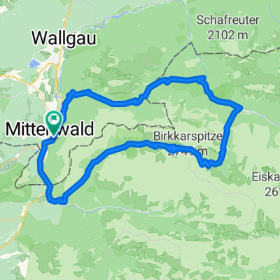
Overview
About this route
<<< Transalp von Ost nach West >>>
Zur dritten Etappe Von Mittenwald geht es am Wettersteinmassiv vorbei, immer an der Leutasch aufwerts, bis es endlich nach Ehrwald bergab geht. Weiter folgt man der Via Claudia über den Fernpass bis zum Fernsteinsee, dort hält man sich rechts und biegt auf eine irrsinnig steile Forstsraße ab, die aber plötzlich abflacht und zur Tarrenton Alm führt. Ab hier beginnt eine 3 Stündige Radwanderung zur Anhalterhütte.- -:--
- Duration
- 73.5 km
- Distance
- 2,172 m
- Ascent
- 1,155 m
- Descent
- ---
- Avg. speed
- ---
- Avg. speed

Route highlights
Points of interest along the route
Accommodation after 67.8 km
Tarrentonalm Tel.: +43 (664) 6332504
Continue with Bikemap
Use, edit, or download this cycling route
You would like to ride Massiv Alp 3: Mittenwald- Anhalter Hütte or customize it for your own trip? Here is what you can do with this Bikemap route:
Free features
- Save this route as favorite or in collections
- Copy & plan your own version of this route
- Sync your route with Garmin or Wahoo
Premium features
Free trial for 3 days, or one-time payment. More about Bikemap Premium.
- Navigate this route on iOS & Android
- Export a GPX / KML file of this route
- Create your custom printout (try it for free)
- Download this route for offline navigation
Discover more Premium features.
Get Bikemap PremiumFrom our community
Other popular routes starting in Mittenwald
 Karwendeltour
- Distance
- 78.4 km
- Ascent
- 1,998 m
- Descent
- 1,998 m
- Location
- Mittenwald, Bavaria, Germany
 Unbenannte Route
- Distance
- 120.7 km
- Ascent
- 1,501 m
- Descent
- 1,727 m
- Location
- Mittenwald, Bavaria, Germany
 Karwendelrunde
- Distance
- 65 km
- Ascent
- 1,582 m
- Descent
- 1,572 m
- Location
- Mittenwald, Bavaria, Germany
 Letzte Etappe Ulm-Gardasee-Ulm
- Distance
- 214.9 km
- Ascent
- 1,305 m
- Descent
- 1,666 m
- Location
- Mittenwald, Bavaria, Germany
 Soiern-Runde
- Distance
- 48.6 km
- Ascent
- 945 m
- Descent
- 945 m
- Location
- Mittenwald, Bavaria, Germany
 Mittenwald-ElmauerAlm-HoherKranzberg-Arnspitzrunde
- Distance
- 70.3 km
- Ascent
- 1,142 m
- Descent
- 1,142 m
- Location
- Mittenwald, Bavaria, Germany
 Mittenwald_München
- Distance
- 115.5 km
- Ascent
- 214 m
- Descent
- 603 m
- Location
- Mittenwald, Bavaria, Germany
 Karwendelrunde light - Mittenwald - Scharnitz - Karwendelhaus - Hinterriss - Vorderriss - Wallgau
- Distance
- 75.5 km
- Ascent
- 1,530 m
- Descent
- 1,530 m
- Location
- Mittenwald, Bavaria, Germany
Open it in the app