

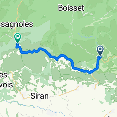
Olonzac - Minerve - Homps
A cycling route starting in Olonzac, Occitanie, France.
Overview
About this route
- -:--
- Duration
- 34.5 km
- Distance
- 445 m
- Ascent
- 446 m
- Descent
- ---
- Avg. speed
- ---
- Max. altitude
Route quality
Waytypes & surfaces along the route
Waytypes
Road
23.8 km
(69 %)
Quiet road
5.5 km
(16 %)
Undefined
5.2 km
(15 %)
Surfaces
Paved
0.7 km
(2 %)
Asphalt
0.7 km
(2 %)
Undefined
33.8 km
(98 %)
Continue with Bikemap
Use, edit, or download this cycling route
You would like to ride Olonzac - Minerve - Homps or customize it for your own trip? Here is what you can do with this Bikemap route:
Free features
- Save this route as favorite or in collections
- Copy & plan your own version of this route
- Sync your route with Garmin or Wahoo
Premium features
Free trial for 3 days, or one-time payment. More about Bikemap Premium.
- Navigate this route on iOS & Android
- Export a GPX / KML file of this route
- Create your custom printout (try it for free)
- Download this route for offline navigation
Discover more Premium features.
Get Bikemap PremiumFrom our community
Other popular routes starting in Olonzac
 1.5 Olonzac - Montagnac
- Distance
- 69.8 km
- Ascent
- 266 m
- Descent
- 286 m
- Location
- Olonzac, Occitanie, France
 Bordeaux 7
- Distance
- 26.5 km
- Ascent
- 40 m
- Descent
- 69 m
- Location
- Olonzac, Occitanie, France
 Homps 2b variant
- Distance
- 54.1 km
- Ascent
- 394 m
- Descent
- 393 m
- Location
- Olonzac, Occitanie, France
 Etape 17– De Minerve à Saint-Julien-des-Meulières - Itinéraire Sud
- Distance
- 14.2 km
- Ascent
- 440 m
- Descent
- 186 m
- Location
- Olonzac, Occitanie, France
 Canal du midi jour 5
- Distance
- 40 km
- Ascent
- 50 m
- Descent
- 90 m
- Location
- Olonzac, Occitanie, France
 Homps-Lagrasse
- Distance
- 111.8 km
- Ascent
- 936 m
- Descent
- 865 m
- Location
- Olonzac, Occitanie, France
 France minerve to rieux-minervois
- Distance
- 37.9 km
- Ascent
- 340 m
- Descent
- 450 m
- Location
- Olonzac, Occitanie, France
 Canal du Midi: Tourouzelle - Beziers
- Distance
- 61.5 km
- Ascent
- 880 m
- Descent
- 898 m
- Location
- Olonzac, Occitanie, France
Open it in the app