

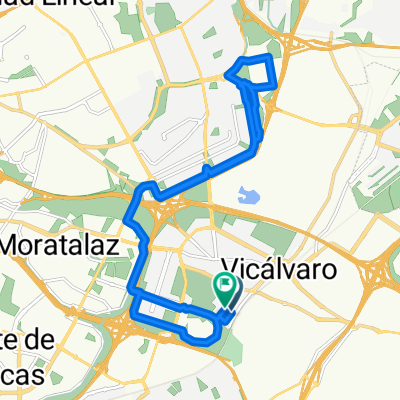
cerro almodovar
A cycling route starting in Vicálvaro, Madrid, Spain.
Overview
About this route
una buena ruta para pasarselo bien en los descensos
- -:--
- Duration
- 7.8 km
- Distance
- 156 m
- Ascent
- 158 m
- Descent
- ---
- Avg. speed
- ---
- Max. altitude

Continue with Bikemap
Use, edit, or download this cycling route
You would like to ride cerro almodovar or customize it for your own trip? Here is what you can do with this Bikemap route:
Free features
- Save this route as favorite or in collections
- Copy & plan your own version of this route
- Sync your route with Garmin or Wahoo
Premium features
Free trial for 3 days, or one-time payment. More about Bikemap Premium.
- Navigate this route on iOS & Android
- Export a GPX / KML file of this route
- Create your custom printout (try it for free)
- Download this route for offline navigation
Discover more Premium features.
Get Bikemap PremiumFrom our community
Other popular routes starting in Vicálvaro
 Calle de la Caliza, Madrid a Calle de Minerva, Madrid
- Distance
- 28.6 km
- Ascent
- 237 m
- Descent
- 235 m
- Location
- Vicálvaro, Madrid, Spain
 Calle del Molino Viejo, Madrid a Calle del Campo de la Torre, Madrid
- Distance
- 20.8 km
- Ascent
- 148 m
- Descent
- 142 m
- Location
- Vicálvaro, Madrid, Spain
 Vicalvaro - Cortados de Rivas
- Distance
- 36.6 km
- Ascent
- 230 m
- Descent
- 244 m
- Location
- Vicálvaro, Madrid, Spain
 De Calle de Minerva a Calle de Villablanca
- Distance
- 9.3 km
- Ascent
- 76 m
- Descent
- 139 m
- Location
- Vicálvaro, Madrid, Spain
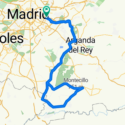
 20150321_Brevet_200_Vicalvaro
- Distance
- 204.9 km
- Ascent
- 824 m
- Descent
- 823 m
- Location
- Vicálvaro, Madrid, Spain
 Anillo Verde
- Distance
- 68.8 km
- Ascent
- 410 m
- Descent
- 410 m
- Location
- Vicálvaro, Madrid, Spain
 Alternativa Brevet 200k Vicalvaro - Ocaña
- Distance
- 145 km
- Ascent
- 577 m
- Descent
- 577 m
- Location
- Vicálvaro, Madrid, Spain
 Vicálvaro-Anillo ciclista-El Pardo
- Distance
- 68.3 km
- Ascent
- 521 m
- Descent
- 521 m
- Location
- Vicálvaro, Madrid, Spain
Open it in the app