

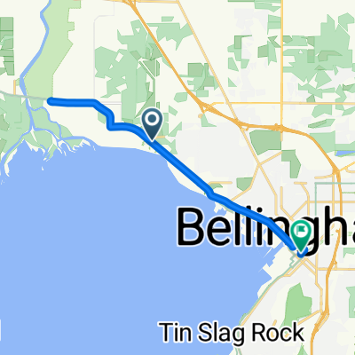
Chuckanut Century North 2
A cycling route starting in Marietta-Alderwood, Washington, United States.
Overview
About this route
- -:--
- Duration
- 74.2 km
- Distance
- 304 m
- Ascent
- 328 m
- Descent
- ---
- Avg. speed
- ---
- Max. altitude

Route quality
Waytypes & surfaces along the route
Waytypes
Road
39.3 km
(53 %)
Quiet road
23 km
(31 %)
Surfaces
Paved
46.8 km
(63 %)
Asphalt
36.4 km
(49 %)
Paved (undefined)
10.4 km
(14 %)
Undefined
27.5 km
(37 %)
Continue with Bikemap
Use, edit, or download this cycling route
You would like to ride Chuckanut Century North 2 or customize it for your own trip? Here is what you can do with this Bikemap route:
Free features
- Save this route as favorite or in collections
- Copy & plan your own version of this route
- Sync your route with Garmin or Wahoo
Premium features
Free trial for 3 days, or one-time payment. More about Bikemap Premium.
- Navigate this route on iOS & Android
- Export a GPX / KML file of this route
- Create your custom printout (try it for free)
- Download this route for offline navigation
Discover more Premium features.
Get Bikemap PremiumFrom our community
Other popular routes starting in Marietta-Alderwood
 Bellingham to Vancouver
- Distance
- 106.5 km
- Ascent
- 1,505 m
- Descent
- 1,438 m
- Location
- Marietta-Alderwood, Washington, United States
 3150 W Maplewood Ave, Bellingham to 1227 W Bakerview Rd, Bellingham
- Distance
- 1.1 km
- Ascent
- 17 m
- Descent
- 7 m
- Location
- Marietta-Alderwood, Washington, United States
 Airport Dr, Bellingham to 2858 W Maplewood Ave, Bellingham
- Distance
- 33.5 km
- Ascent
- 393 m
- Descent
- 414 m
- Location
- Marietta-Alderwood, Washington, United States
 Guide Meridian 4647, Bellingham to Portal Way 7080, Ferndale
- Distance
- 17 km
- Ascent
- 47 m
- Descent
- 83 m
- Location
- Marietta-Alderwood, Washington, United States
 Chuckanut Century North 2
- Distance
- 74.2 km
- Ascent
- 304 m
- Descent
- 328 m
- Location
- Marietta-Alderwood, Washington, United States
 Home Rd, Bellingham to E Holly St, Bellingham
- Distance
- 5.9 km
- Ascent
- 41 m
- Descent
- 79 m
- Location
- Marietta-Alderwood, Washington, United States
 4623 Bedford Ave, Bellingham to 2858 W Maplewood Ave, Bellingham
- Distance
- 6.8 km
- Ascent
- 117 m
- Descent
- 124 m
- Location
- Marietta-Alderwood, Washington, United States
 Marine Dr, Marietta to E Holly St, Bellingham
- Distance
- 13.7 km
- Ascent
- 103 m
- Descent
- 123 m
- Location
- Marietta-Alderwood, Washington, United States
Open it in the app