- 55.6 km
- 522 m
- 515 m
- Windischeschenbach, Bavaria, Germany
Německo 2012_Waldnaabtal-Ohře-D1-18.9.Út
A cycling route starting in Windischeschenbach, Bavaria, Germany.
Overview
About this route
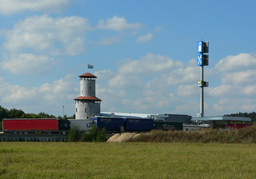
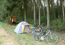
In the afternoon, we get off at the station in Windischeschenbach and ride up above the town to connect to the Waldnaabtal-Radweg. I finished here in May of this year, so I want to ride to the end of the route in Germany and then continue along the Ohře River all the way to our home in Chomutov. After connecting to the route, we continue through the gorge along the creek to Falkenberg, where we connect to the Naab-Wondreb-Radweg route (unfortunately, this official route is not yet recorded on Bikemap). The route leads through beautiful forests and around ponds to Mittereich (taking a detour) and continues onward to Königshütte, where we spend the night above the village at the edge of the forest. The place is perfectly chosen because in the evening we have a beautiful view into the valley of Waldsassen, where the Basilica is illuminated, which we plan to visit tomorrow, and moreover, by sleeping on top of the hill and not in the valley, we avoid a few degrees of cold at dawn. At night, it rains intermittently almost until dawn, but around seven o'clock the sun shines and nicely dries our tent and, furthermore, the temperature inside the tent rises perfectly. What more could one wish for? The day starts off wonderfully.
- -:--
- Duration
- 34.5 km
- Distance
- 366 m
- Ascent
- 240 m
- Descent
- ---
- Avg. speed
- ---
- Max. altitude
created this 13 years ago
Route quality
Waytypes & surfaces along the route
Waytypes
Track
22.1 km
(64 %)
Quiet road
9.7 km
(28 %)
Surfaces
Paved
11.1 km
(32 %)
Unpaved
20.7 km
(60 %)
Gravel
15.2 km
(44 %)
Asphalt
6.6 km
(19 %)
Route highlights
Points of interest along the route

Photo after 1.5 km

Photo after 3.4 km

Photo after 5.3 km
opět odpočivadlo s možným spaním

Photo after 10.2 km
Perfektní pro děti

Photo after 10.2 km
Občerstvovna

Photo after 15.1 km
Falkenberk

Photo after 15.9 km
odpočíváme, hezké místo

Photo after 34.5 km
1.nocleh, hezky nahoře na kopci a tak ,aby na nás ráno svítilo sluníčko

Photo after 34.5 km
podvečerní pohled do údolí a na Waldsassen, který nás čeká zítra
Continue with Bikemap
Use, edit, or download this cycling route
You would like to ride Německo 2012_Waldnaabtal-Ohře-D1-18.9.Út or customize it for your own trip? Here is what you can do with this Bikemap route:
Free features
- Save this route as favorite or in collections
- Copy & plan your own version of this route
- Sync your route with Garmin or Wahoo
Premium features
Free trial for 3 days, or one-time payment. More about Bikemap Premium.
- Navigate this route on iOS & Android
- Export a GPX / KML file of this route
- Create your custom printout (try it for free)
- Download this route for offline navigation
Discover more Premium features.
Get Bikemap PremiumFrom our community
Other popular routes starting in Windischeschenbach
- Wurz-Pressath-Neustadt-Wurz
- B 2015 Entwurf neu
- 168.6 km
- 1,334 m
- 1,335 m
- Windischeschenbach, Bavaria, Germany
- B- Strecke PT 2011
- 181.9 km
- 1,620 m
- 1,620 m
- Windischeschenbach, Bavaria, Germany
- 2014 Waldnaab-Pegnitz
- 72.8 km
- 578 m
- 659 m
- Windischeschenbach, Bavaria, Germany
- D 2013
- 74.7 km
- 767 m
- 770 m
- Windischeschenbach, Bavaria, Germany
- C-Strecke PT 2011
- 101.7 km
- 1,191 m
- 1,192 m
- Windischeschenbach, Bavaria, Germany
- RR1 01.05.12
- 119.4 km
- 1,129 m
- 1,129 m
- Windischeschenbach, Bavaria, Germany
- 2013 - PanTourC
- 113 km
- 979 m
- 979 m
- Windischeschenbach, Bavaria, Germany
Open it in the app


