


Traisenradweg Traisen-St.Aegyd/N.
- 29.9 km
- 335 m
- 163 m
- Traisen, Lower Austria, Austria
A cycling route starting in Traisen, Lower Austria, Austria.
Overview
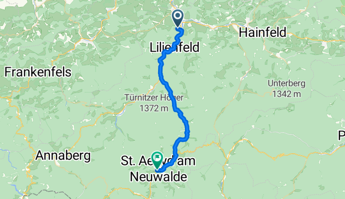
Traisental bike path from Traisen (campsite) - Lillienfeld - Freiland - Hohenhberg - St-Aegyd am Neuwald and back
created this 13 years ago
Route quality
Quiet road
12.3 km
(41 %)
Cycleway
5.7 km
(19 %)
Paved
14.7 km
(49 %)
Asphalt
14.7 km
(49 %)
Undefined
15.3 km
(51 %)
Continue with Bikemap
You would like to ride Traisenradweg Traisen-St.Aegyd/N. or customize it for your own trip? Here is what you can do with this Bikemap route:
Free trial for 3 days, or one-time payment. More about Bikemap Premium.
Discover more Premium features.
Get Bikemap PremiumFrom our community
Open it in the app


