
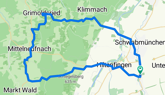

Flache Saisonabschlussrunde
- 37.7 km
- 102 m
- 100 m
- Langerringen, Bavaria, Germany
A cycling route starting in Langerringen, Bavaria, Germany.
Overview
A very beautiful route, especially in good weather. You are mostly undisturbed (cars, etc.), the surroundings are very quiet, and the small villages with wide fields and forests have something very appealing and very motivating. At first, flatland or light hill riders should hold back, as from about halfway you already notice that it is very tough, with many climbs followed by descents and climbs again, resulting in muscle fatigue. On the route, there are some challenging hills followed by very fast descents.
If you live nearby and want to get out of your 'large village' or small town to get some fresh air, you should definitely try this route.
It should be ridden with a mountain bike, as some sections require wide tires that grip reasonably well even on coarse gravel.
With an average speed of 21.5 km/h, the route can be completed in exactly 2 hours.
Have fun trying it out!
Route quality
Quiet road
15.6 km
(38 %)
Track
13.2 km
(32 %)
Paved
27.2 km
(66 %)
Unpaved
12.3 km
(30 %)
Asphalt
27.2 km
(66 %)
Loose gravel
7.4 km
(18 %)
Route highlights
Continue with Bikemap
You would like to ride Staudentour or customize it for your own trip? Here is what you can do with this Bikemap route:
Free trial for 3 days, or one-time payment. More about Bikemap Premium.
Discover more Premium features.
Get Bikemap PremiumFrom our community
Open it in the app


