Remshalden - unterhalb Korber Kopf - Buoch-Remshalden
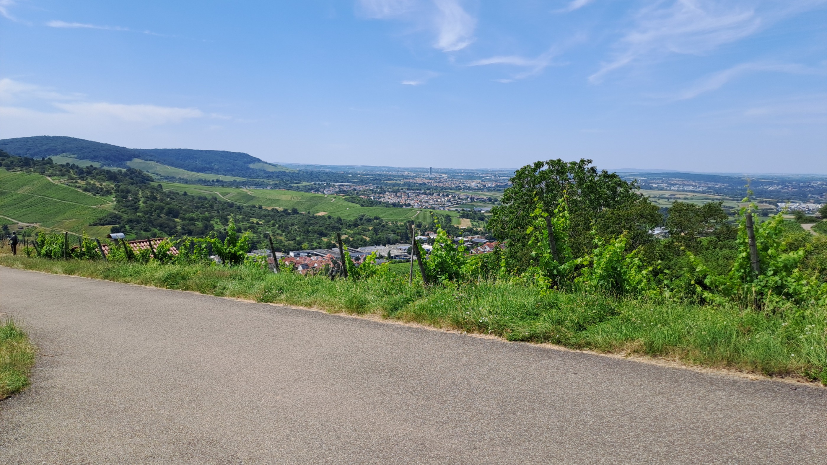
A cycling route starting in Weinstadt-Endersbach, Baden-Württemberg, Germany.
Overview
About this route
Tour bietet Weinberge, Ausblicke, Wälder und Fluss (Rems)
- -:--
- Duration
- 42.9 km
- Distance
- 391 m
- Ascent
- 393 m
- Descent
- ---
- Avg. speed
- ---
- Avg. speed
Route quality
Waytypes & surfaces along the route
Waytypes
Track
25.3 km
(59 %)
Quiet road
11 km
(26 %)
Surfaces
Paved
33.3 km
(78 %)
Unpaved
9.4 km
(22 %)
Asphalt
31.2 km
(73 %)
Gravel
8.8 km
(20 %)
Route highlights
Points of interest along the route
Point of interest after 13.9 km
Reif zur Weinlese
Continue with Bikemap
Use, edit, or download this cycling route
You would like to ride Remshalden - unterhalb Korber Kopf - Buoch-Remshalden or customize it for your own trip? Here is what you can do with this Bikemap route:
Free features
- Save this route as favorite or in collections
- Copy & plan your own version of this route
- Sync your route with Garmin or Wahoo
Premium features
Free trial for 3 days, or one-time payment. More about Bikemap Premium.
- Navigate this route on iOS & Android
- Export a GPX / KML file of this route
- Create your custom printout (try it for free)
- Download this route for offline navigation
Discover more Premium features.
Get Bikemap PremiumFrom our community
Other popular routes starting in Weinstadt-Endersbach
- Remstal und Schurwal mit Ausblick
- Distance
- 34.4 km
- Ascent
- 453 m
- Descent
- 453 m
- Location
- Weinstadt-Endersbach, Baden-Württemberg, Germany
- Leichte Trainingsstrecke um Kernen
- Distance
- 26.3 km
- Ascent
- 164 m
- Descent
- 203 m
- Location
- Weinstadt-Endersbach, Baden-Württemberg, Germany
- Remstal and more
- Distance
- 32.3 km
- Ascent
- 315 m
- Descent
- 315 m
- Location
- Weinstadt-Endersbach, Baden-Württemberg, Germany
- Grunbach - Schorndorf - Mannshaupten - Königstein - Kreuzeiche - Korber Schützenhaus - Großheppach - Grunbach
- Distance
- 35.9 km
- Ascent
- 594 m
- Descent
- 581 m
- Location
- Weinstadt-Endersbach, Baden-Württemberg, Germany
- RTF Weinstadt-Tour 09
- Distance
- 111.9 km
- Ascent
- 1,519 m
- Descent
- 1,438 m
- Location
- Weinstadt-Endersbach, Baden-Württemberg, Germany
- Beutelsbsch- Saffrichhof-Winterbach
- Distance
- 17.7 km
- Ascent
- 306 m
- Descent
- 380 m
- Location
- Weinstadt-Endersbach, Baden-Württemberg, Germany
- Schöne Aussicht Berglen
- Distance
- 50.5 km
- Ascent
- 469 m
- Descent
- 468 m
- Location
- Weinstadt-Endersbach, Baden-Württemberg, Germany
- Remshalden - unterhalb Korber Kopf - Buoch-Remshalden
- Distance
- 42.9 km
- Ascent
- 391 m
- Descent
- 393 m
- Location
- Weinstadt-Endersbach, Baden-Württemberg, Germany
Open it in the app