

2012 French Tour -- Ride Day 36 -- 23 September 2012 -- Chambéry to Seyssins (Grenoble)
A cycling route starting in La Motte-Servolex, Auvergne-Rhône-Alpes, France.
Overview
About this route
To be added later...
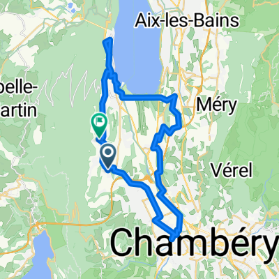
Excellent day of plenty of climbing and descending. The D912/D512 portions (the bulk of the ride) had some traffic, but not much. The portion from Chambéry to the Col du Granier was filled with local riders taking advantage of this Sunday with perfect weather. After that, there were only a few riders until getting close to Grenoble. The descent from the Col de Porte (1326 M) was long and steep. Make sure that your brakes are working properly. And when arriving at the first overlook high above Grenoble, the view was really something. Within Grenoble itself, there were plenty of bike paths. <div><br /></div>
- -:--
- Duration
- 75.6 km
- Distance
- 1,821 m
- Ascent
- 1,846 m
- Descent
- ---
- Avg. speed
- ---
- Max. altitude

Route quality
Waytypes & surfaces along the route
Waytypes
Cycleway
6.1 km
(8 %)
Road
5.3 km
(7 %)
Surfaces
Paved
59 km
(78 %)
Unpaved
0.8 km
(1 %)
Asphalt
59 km
(78 %)
Ground
0.8 km
(1 %)
Undefined
15.9 km
(21 %)
Continue with Bikemap
Use, edit, or download this cycling route
You would like to ride 2012 French Tour -- Ride Day 36 -- 23 September 2012 -- Chambéry to Seyssins (Grenoble) or customize it for your own trip? Here is what you can do with this Bikemap route:
Free features
- Save this route as favorite or in collections
- Copy & plan your own version of this route
- Sync your route with Garmin or Wahoo
Premium features
Free trial for 3 days, or one-time payment. More about Bikemap Premium.
- Navigate this route on iOS & Android
- Export a GPX / KML file of this route
- Create your custom printout (try it for free)
- Download this route for offline navigation
Discover more Premium features.
Get Bikemap PremiumFrom our community
Other popular routes starting in La Motte-Servolex
 LES BALCONS DU LAC duBOURGET SAVOIE
- Distance
- 40.1 km
- Ascent
- 383 m
- Descent
- 378 m
- Location
- La Motte-Servolex, Auvergne-Rhône-Alpes, France
 09-08-16 ERT-8.Etappe: Chambéry-Col du Galdon-Grenoble
- Distance
- 158.8 km
- Ascent
- 2,720 m
- Descent
- 2,425 m
- Location
- La Motte-Servolex, Auvergne-Rhône-Alpes, France
 TourVTTGranier
- Distance
- 61.5 km
- Ascent
- 1,445 m
- Descent
- 1,446 m
- Location
- La Motte-Servolex, Auvergne-Rhône-Alpes, France
 la motte pragondran traversée sousle nivolet
- Distance
- 40.1 km
- Ascent
- 1,047 m
- Descent
- 1,057 m
- Location
- La Motte-Servolex, Auvergne-Rhône-Alpes, France
 maison barbiset epine relais epine maison
- Distance
- 45 km
- Ascent
- 1,436 m
- Descent
- 1,436 m
- Location
- La Motte-Servolex, Auvergne-Rhône-Alpes, France
 7-GRENOBLE
- Distance
- 102.9 km
- Ascent
- 2,757 m
- Descent
- 2,796 m
- Location
- La Motte-Servolex, Auvergne-Rhône-Alpes, France
 Chambéry -Alberville
- Distance
- 67.5 km
- Ascent
- 1,052 m
- Descent
- 1,016 m
- Location
- La Motte-Servolex, Auvergne-Rhône-Alpes, France
 tour infernal diminué
- Distance
- 74.3 km
- Ascent
- 1,646 m
- Descent
- 1,645 m
- Location
- La Motte-Servolex, Auvergne-Rhône-Alpes, France
Open it in the app