

Raynes Park to Streatham Common commute
A cycling route starting in New Malden, England, United Kingdom.
Overview
About this route
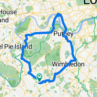
The route shows a route using back lanes and joining up existing bike routes from Raynes Park to Streatham Common.
This route includes a little known bike connection from Colliers Wood to Mitcham Figgs Marsh.
Also a little known connection from Tooting to Streatham Common avoiding major and side roads.
- -:--
- Duration
- 8.6 km
- Distance
- 28 m
- Ascent
- 0 m
- Descent
- ---
- Avg. speed
- ---
- Max. altitude
Route highlights
Points of interest along the route
Point of interest after 3.7 km
The Wandle Trail connection
Point of interest after 3.9 km
The Wandle Trail connection
Point of interest after 4.8 km
Join the route route from Devonshire Road
Continue with Bikemap
Use, edit, or download this cycling route
You would like to ride Raynes Park to Streatham Common commute or customize it for your own trip? Here is what you can do with this Bikemap route:
Free features
- Save this route as favorite or in collections
- Copy & plan your own version of this route
- Sync your route with Garmin or Wahoo
Premium features
Free trial for 3 days, or one-time payment. More about Bikemap Premium.
- Navigate this route on iOS & Android
- Export a GPX / KML file of this route
- Create your custom printout (try it for free)
- Download this route for offline navigation
Discover more Premium features.
Get Bikemap PremiumFrom our community
Other popular routes starting in New Malden
 Motspur - New Malden Loop
- Distance
- 8.3 km
- Ascent
- 8 m
- Descent
- 8 m
- Location
- New Malden, England, United Kingdom
 Pimlico & Cycle superhighways
- Distance
- 51.3 km
- Ascent
- 964 m
- Descent
- 997 m
- Location
- New Malden, England, United Kingdom
 hammersmith putnry
- Distance
- 34.1 km
- Ascent
- 68 m
- Descent
- 72 m
- Location
- New Malden, England, United Kingdom
 Prova 1
- Distance
- 24.7 km
- Ascent
- 83 m
- Descent
- 84 m
- Location
- New Malden, England, United Kingdom
 Woodlands to Motspur/WP high street loop
- Distance
- 7.9 km
- Ascent
- 48 m
- Descent
- 46 m
- Location
- New Malden, England, United Kingdom
 From Wimbledon common to Hampton Court
- Distance
- 2.1 km
- Ascent
- 0 m
- Descent
- 42 m
- Location
- New Malden, England, United Kingdom
 Norbiton to Windsor and back.
- Distance
- 79.9 km
- Ascent
- 117 m
- Descent
- 117 m
- Location
- New Malden, England, United Kingdom
 Motspur - New Malden - Worcester Park Loop
- Distance
- 15 km
- Ascent
- 25 m
- Descent
- 24 m
- Location
- New Malden, England, United Kingdom
Open it in the app