

19.05.12 - Rund um den Schöckl CLONED FROM ROUTE 1599358
A cycling route starting in Fernitz, Styria, Austria.
Overview
About this route
Aufstieg von Peggau zum Jägerwirt
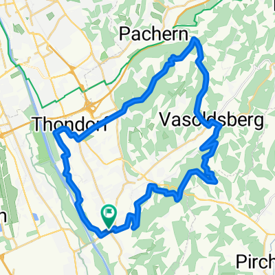
Von Fernitz am Murradweg nach Norden bis Peggau , dort beginnt die Bergwertung hinauf nach Semrich , eine herrlich einsame Strecke mit teilweise schönen Ausblicken ! Es folgt eine kurze Abfahrt nach Semrich , danach steigt es wieder hinauf zum Jägerwirt, wobei man ständig den Schöckl im Blickfeld hat.Am Schöcklkreuz ist der höchste Punkt des Tages erreicht und es folgt die Lange Abfahrt über Radegund und Fasslberg , bis nach Fernitz .
Verkehrsaufkommen meist sehr gering bis fast nicht vorhanden .
- -:--
- Duration
- 95.9 km
- Distance
- 1,010 m
- Ascent
- 1,010 m
- Descent
- ---
- Avg. speed
- ---
- Max. altitude

Route quality
Waytypes & surfaces along the route
Waytypes
Quiet road
34.8 km
(36 %)
Busy road
31.5 km
(33 %)
Surfaces
Paved
81.7 km
(85 %)
Unpaved
4.2 km
(4 %)
Asphalt
80.6 km
(84 %)
Gravel
1.9 km
(2 %)
Continue with Bikemap
Use, edit, or download this cycling route
You would like to ride 19.05.12 - Rund um den Schöckl CLONED FROM ROUTE 1599358 or customize it for your own trip? Here is what you can do with this Bikemap route:
Free features
- Save this route as favorite or in collections
- Copy & plan your own version of this route
- Split it into stages to create a multi-day tour
- Sync your route with Garmin or Wahoo
Premium features
Free trial for 3 days, or one-time payment. More about Bikemap Premium.
- Navigate this route on iOS & Android
- Export a GPX / KML file of this route
- Create your custom printout (try it for free)
- Download this route for offline navigation
Discover more Premium features.
Get Bikemap PremiumFrom our community
Other popular routes starting in Fernitz
 1.5.10 - Durchs Blütenmeer der Apfelstrasse - Kulm
- Distance
- 116.9 km
- Ascent
- 1,203 m
- Descent
- 1,203 m
- Location
- Fernitz, Styria, Austria
 Badgamser Panoramastraße
- Distance
- 82.7 km
- Ascent
- 952 m
- Descent
- 951 m
- Location
- Fernitz, Styria, Austria
 Wolfsgrabenrunde
- Distance
- 32.3 km
- Ascent
- 411 m
- Descent
- 410 m
- Location
- Fernitz, Styria, Austria
 fernitz-hühnerberg-schloss waasen-kollisch-werndorf-kalsdorf-fernitz
- Distance
- 30.6 km
- Ascent
- 254 m
- Descent
- 253 m
- Location
- Fernitz, Styria, Austria
 7.4.10 - MTB Extra - Plabutsch - Florianiberg
- Distance
- 46.2 km
- Ascent
- 569 m
- Descent
- 570 m
- Location
- Fernitz, Styria, Austria
 19.02.11 - MTB - Mellachberg
- Distance
- 13.1 km
- Ascent
- 335 m
- Descent
- 331 m
- Location
- Fernitz, Styria, Austria
 27.06.10 - Kirschen tour rund um Gleisdorf
- Distance
- 98.4 km
- Ascent
- 1,083 m
- Descent
- 1,083 m
- Location
- Fernitz, Styria, Austria
 19.05.12 - Rund um den Schöckl
- Distance
- 95.9 km
- Ascent
- 1,010 m
- Descent
- 1,010 m
- Location
- Fernitz, Styria, Austria
Open it in the app