

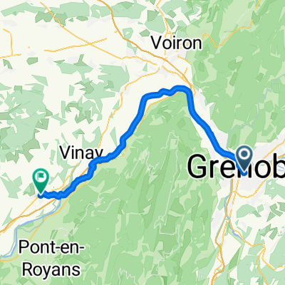
ancien tram-vouillants
A cycling route starting in Saint-Martin-le-Vinoux, Auvergne-Rhône-Alpes, France.
Overview
About this route
Great route Fast uphill and technical downhill
- -:--
- Duration
- 18.4 km
- Distance
- 587 m
- Ascent
- 585 m
- Descent
- ---
- Avg. speed
- ---
- Max. altitude
Route highlights
Points of interest along the route

Point of interest after 6.8 km

Point of interest after 8.6 km
construction de l'ancienne voie du tram grenoble - villard de lans.
Continue with Bikemap
Use, edit, or download this cycling route
You would like to ride ancien tram-vouillants or customize it for your own trip? Here is what you can do with this Bikemap route:
Free features
- Save this route as favorite or in collections
- Copy & plan your own version of this route
- Sync your route with Garmin or Wahoo
Premium features
Free trial for 3 days, or one-time payment. More about Bikemap Premium.
- Navigate this route on iOS & Android
- Export a GPX / KML file of this route
- Create your custom printout (try it for free)
- Download this route for offline navigation
Discover more Premium features.
Get Bikemap PremiumFrom our community
Other popular routes starting in Saint-Martin-le-Vinoux
 Grenoble to Barcelona
- Distance
- 751.8 km
- Ascent
- 570 m
- Descent
- 770 m
- Location
- Saint-Martin-le-Vinoux, Auvergne-Rhône-Alpes, France
 training path
- Distance
- 33.7 km
- Ascent
- 43 m
- Descent
- 45 m
- Location
- Saint-Martin-le-Vinoux, Auvergne-Rhône-Alpes, France
 Vercors
- Distance
- 80.9 km
- Ascent
- 1,307 m
- Descent
- 1,318 m
- Location
- Saint-Martin-le-Vinoux, Auvergne-Rhône-Alpes, France
 col de la placette
- Distance
- 58.7 km
- Ascent
- 523 m
- Descent
- 522 m
- Location
- Saint-Martin-le-Vinoux, Auvergne-Rhône-Alpes, France
 12 March 23, bike stroll (Saint Laurent)
- Distance
- 6.6 km
- Ascent
- 28 m
- Descent
- 23 m
- Location
- Saint-Martin-le-Vinoux, Auvergne-Rhône-Alpes, France
 A 02-04-GENOBLE/SAINT MARCELLIN 52KM
- Distance
- 51.3 km
- Ascent
- 251 m
- Descent
- 185 m
- Location
- Saint-Martin-le-Vinoux, Auvergne-Rhône-Alpes, France
 Tour de France - Etappe 20
- Distance
- 42.8 km
- Ascent
- 424 m
- Descent
- 417 m
- Location
- Saint-Martin-le-Vinoux, Auvergne-Rhône-Alpes, France
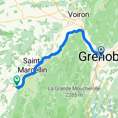 Saint-Martin-le-Vinoux - Saint-Lattier
- Distance
- 64.6 km
- Ascent
- 490 m
- Descent
- 521 m
- Location
- Saint-Martin-le-Vinoux, Auvergne-Rhône-Alpes, France
Open it in the app