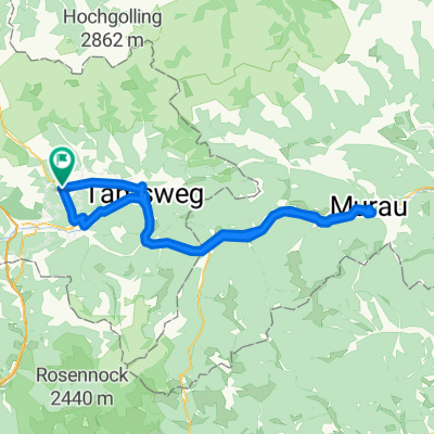
Katschbergrunde
A cycling route starting in Mauterndorf, Salzburg, Austria.
Overview
About this route
- -:--
- Duration
- 65 km
- Distance
- 1,449 m
- Ascent
- 1,439 m
- Descent
- ---
- Avg. speed
- ---
- Avg. speed
Route quality
Waytypes & surfaces along the route
Waytypes
Busy road
36.1 km
(55 %)
Road
13.3 km
(20 %)
Surfaces
Paved
26.2 km
(40 %)
Unpaved
3 km
(5 %)
Asphalt
25.9 km
(40 %)
Unpaved (undefined)
2.6 km
(4 %)
Continue with Bikemap
Use, edit, or download this cycling route
You would like to ride Katschbergrunde or customize it for your own trip? Here is what you can do with this Bikemap route:
Free features
- Save this route as favorite or in collections
- Copy & plan your own version of this route
- Sync your route with Garmin or Wahoo
Premium features
Free trial for 3 days, or one-time payment. More about Bikemap Premium.
- Navigate this route on iOS & Android
- Export a GPX / KML file of this route
- Create your custom printout (try it for free)
- Download this route for offline navigation
Discover more Premium features.
Get Bikemap PremiumFrom our community
Other popular routes starting in Mauterndorf
- mauterndorf-turrach-nockalmstraße-mauterndorf
- Distance
- 115 km
- Ascent
- 2,679 m
- Descent
- 2,687 m
- Location
- Mauterndorf, Salzburg, Austria
- Katschbergrunde
- Distance
- 65 km
- Ascent
- 1,449 m
- Descent
- 1,439 m
- Location
- Mauterndorf, Salzburg, Austria
- Mauterndorf Cycling
- Distance
- 34.2 km
- Ascent
- 1,843 m
- Descent
- 949 m
- Location
- Mauterndorf, Salzburg, Austria
- Z Mautendorfu cez Tamsweg a spat
- Distance
- 34.3 km
- Ascent
- 537 m
- Descent
- 537 m
- Location
- Mauterndorf, Salzburg, Austria
- 42/680_Weisspriachtal_rt
- Distance
- 41.7 km
- Ascent
- 735 m
- Descent
- 736 m
- Location
- Mauterndorf, Salzburg, Austria
- 2021_Mauterndorf-Lantschfeldhütte-Obertauern-Schladming
- Distance
- 82.9 km
- Ascent
- 1,001 m
- Descent
- 1,366 m
- Location
- Mauterndorf, Salzburg, Austria
- 20130603
- Distance
- 108.4 km
- Ascent
- 411 m
- Descent
- 411 m
- Location
- Mauterndorf, Salzburg, Austria
- Mauterndorf - Weißpriach - Granglerhütte und retour
- Distance
- 40.6 km
- Ascent
- 723 m
- Descent
- 723 m
- Location
- Mauterndorf, Salzburg, Austria
Open it in the app