

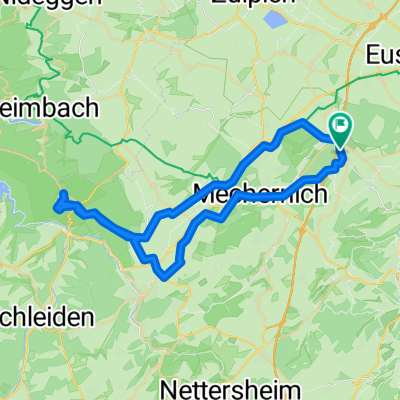
Rund um Hengasch
A cycling route starting in Mechernich, North Rhine-Westphalia, Germany.
Overview
About this route
Schöne Landschaften, tolle Aussicht und abwechselungsreiche Strecke mit unwesentlichen Steigungen...
...und bedingt durch einen anschließenden Unfall (der PKW war stärker) die letzte Fahrt mit meinem GHOST CROSS 9000.
- -:--
- Duration
- 72.6 km
- Distance
- 776 m
- Ascent
- 776 m
- Descent
- ---
- Avg. speed
- ---
- Max. altitude
Route quality
Waytypes & surfaces along the route
Waytypes
Track
39.4 km
(54 %)
Quiet road
11.2 km
(15 %)
Surfaces
Paved
32.9 km
(45 %)
Unpaved
28.9 km
(40 %)
Asphalt
29.2 km
(40 %)
Gravel
23.1 km
(32 %)
Continue with Bikemap
Use, edit, or download this cycling route
You would like to ride Rund um Hengasch or customize it for your own trip? Here is what you can do with this Bikemap route:
Free features
- Save this route as favorite or in collections
- Copy & plan your own version of this route
- Sync your route with Garmin or Wahoo
Premium features
Free trial for 3 days, or one-time payment. More about Bikemap Premium.
- Navigate this route on iOS & Android
- Export a GPX / KML file of this route
- Create your custom printout (try it for free)
- Download this route for offline navigation
Discover more Premium features.
Get Bikemap PremiumFrom our community
Other popular routes starting in Mechernich
 Lessenich - Wolfgarten (Kermeter) und zurück
- Distance
- 46.4 km
- Ascent
- 457 m
- Descent
- 454 m
- Location
- Mechernich, North Rhine-Westphalia, Germany
 Mechernich- Bad Münstereifel- Wasserscheide- Pesch- Mechernich
- Distance
- 55.6 km
- Ascent
- 722 m
- Descent
- 613 m
- Location
- Mechernich, North Rhine-Westphalia, Germany
 Querlenker Tour (35,09km, Start Firmenich)
- Distance
- 35.1 km
- Ascent
- 506 m
- Descent
- 508 m
- Location
- Mechernich, North Rhine-Westphalia, Germany
 EifelSchleife Burg Satzvey (Stadt Mechernich) - EifelSchleife Burg Satzvey (Stadt Mechernich)
- Distance
- 7.3 km
- Ascent
- 105 m
- Descent
- 109 m
- Location
- Mechernich, North Rhine-Westphalia, Germany
 Rundkurs Lessenich-Zingsheim-Lessenich über Römische Straße
- Distance
- 30.9 km
- Ascent
- 439 m
- Descent
- 436 m
- Location
- Mechernich, North Rhine-Westphalia, Germany
 Lessenich - Eschweilerbachtal- Lessenich
- Distance
- 24.5 km
- Ascent
- 244 m
- Descent
- 244 m
- Location
- Mechernich, North Rhine-Westphalia, Germany
 Schmidtheimer Runde
- Distance
- 80.5 km
- Ascent
- 1,023 m
- Descent
- 1,031 m
- Location
- Mechernich, North Rhine-Westphalia, Germany
 Rund um den Rurstausee
- Distance
- 104.5 km
- Ascent
- 1,588 m
- Descent
- 1,609 m
- Location
- Mechernich, North Rhine-Westphalia, Germany
Open it in the app