

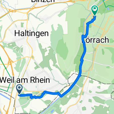
Steinen - Kandern - Tüllingen
A cycling route starting in Riehen, Canton of Basel-City, Switzerland.
Overview
About this route
- -:--
- Duration
- 43.4 km
- Distance
- 524 m
- Ascent
- 524 m
- Descent
- ---
- Avg. speed
- ---
- Max. altitude
Route quality
Waytypes & surfaces along the route
Waytypes
Track
25.2 km
(58 %)
Quiet road
6.5 km
(15 %)
Surfaces
Paved
14.8 km
(34 %)
Unpaved
23.4 km
(54 %)
Gravel
17.8 km
(41 %)
Asphalt
12.6 km
(29 %)
Continue with Bikemap
Use, edit, or download this cycling route
You would like to ride Steinen - Kandern - Tüllingen or customize it for your own trip? Here is what you can do with this Bikemap route:
Free features
- Save this route as favorite or in collections
- Copy & plan your own version of this route
- Sync your route with Garmin or Wahoo
Premium features
Free trial for 3 days, or one-time payment. More about Bikemap Premium.
- Navigate this route on iOS & Android
- Export a GPX / KML file of this route
- Create your custom printout (try it for free)
- Download this route for offline navigation
Discover more Premium features.
Get Bikemap PremiumFrom our community
Other popular routes starting in Riehen
 sirnitz + blauen + lehnacker 2100hm 110km
- Distance
- 113.8 km
- Ascent
- 1,799 m
- Descent
- 1,796 m
- Location
- Riehen, Canton of Basel-City, Switzerland
 basel-neuenburg-retour
- Distance
- 76.9 km
- Ascent
- 118 m
- Descent
- 118 m
- Location
- Riehen, Canton of Basel-City, Switzerland
 Von Weil am Rhein bis Lörrach
- Distance
- 8.2 km
- Ascent
- 62 m
- Descent
- 27 m
- Location
- Riehen, Canton of Basel-City, Switzerland
 Riehen - Kandern -Maulburg - Adelhausen - Riehen
- Distance
- 57.9 km
- Ascent
- 855 m
- Descent
- 732 m
- Location
- Riehen, Canton of Basel-City, Switzerland
 Basel-Weiher Kopf/Heubronn-Basel
- Distance
- 91.4 km
- Ascent
- 1,121 m
- Descent
- 1,136 m
- Location
- Riehen, Canton of Basel-City, Switzerland
 Short Chrischona tour
- Distance
- 12.5 km
- Ascent
- 339 m
- Descent
- 339 m
- Location
- Riehen, Canton of Basel-City, Switzerland
 basel-delemont-basel
- Distance
- 100.7 km
- Ascent
- 348 m
- Descent
- 348 m
- Location
- Riehen, Canton of Basel-City, Switzerland
 sventrail
- Distance
- 13.4 km
- Ascent
- 437 m
- Descent
- 434 m
- Location
- Riehen, Canton of Basel-City, Switzerland
Open it in the app