

Vyhne - Žarnovica
A cycling route starting in Žarnovica, Banská Bystrica Region, Slovakia.
Overview
About this route
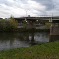
From the accommodation in Vyhnie, I took this route to the start of the Great Hodruš Loop (www.bikomktajchom.sk). I have about 50 vertical meters unresolved from the settlement of Do Koniarov to the good road to Lukavica. I suspect that further south the road I came from Vyhnie will connect with the road to Lukavica. (I crossed through the forest along the water - I do not recommend this).
- -:--
- Duration
- 10.6 km
- Distance
- 281 m
- Ascent
- 429 m
- Descent
- ---
- Avg. speed
- ---
- Max. altitude
Route quality
Waytypes & surfaces along the route
Waytypes
Quiet road
5.1 km
(48 %)
Track
3.9 km
(37 %)
Surfaces
Paved
0.3 km
(3 %)
Unpaved
3.7 km
(35 %)
Unpaved (undefined)
3.1 km
(29 %)
Ground
0.6 km
(6 %)
Route highlights
Points of interest along the route
Point of interest after 4.6 km
Začiatok nevyriešeného úseku - k dobrej ceste
Point of interest after 5 km
Dobrá cesta
Continue with Bikemap
Use, edit, or download this cycling route
You would like to ride Vyhne - Žarnovica or customize it for your own trip? Here is what you can do with this Bikemap route:
Free features
- Save this route as favorite or in collections
- Copy & plan your own version of this route
- Sync your route with Garmin or Wahoo
Premium features
Free trial for 3 days, or one-time payment. More about Bikemap Premium.
- Navigate this route on iOS & Android
- Export a GPX / KML file of this route
- Create your custom printout (try it for free)
- Download this route for offline navigation
Discover more Premium features.
Get Bikemap PremiumFrom our community
Other popular routes starting in Žarnovica
 sobota robota 23.3.19
- Distance
- 16 km
- Ascent
- 166 m
- Descent
- 202 m
- Location
- Žarnovica, Banská Bystrica Region, Slovakia
 Uhliská - Vysoká - Uhliská
- Distance
- 4.9 km
- Ascent
- 255 m
- Descent
- 276 m
- Location
- Žarnovica, Banská Bystrica Region, Slovakia
 Vyhne - Žarnovica
- Distance
- 10.6 km
- Ascent
- 281 m
- Descent
- 429 m
- Location
- Žarnovica, Banská Bystrica Region, Slovakia
 Bajkom k Tajchom Tour 0. ročník
- Distance
- 39.1 km
- Ascent
- 784 m
- Descent
- 787 m
- Location
- Žarnovica, Banská Bystrica Region, Slovakia
 2.tréning 2019
- Distance
- 19.6 km
- Ascent
- 459 m
- Descent
- 459 m
- Location
- Žarnovica, Banská Bystrica Region, Slovakia
 Žarnovica 18419
- Distance
- 9.8 km
- Ascent
- 413 m
- Descent
- 177 m
- Location
- Žarnovica, Banská Bystrica Region, Slovakia
 Žarnovica - Banská Štiavnica - Sklené Teplice - Žarnovica
- Distance
- 46 km
- Ascent
- 684 m
- Descent
- 687 m
- Location
- Žarnovica, Banská Bystrica Region, Slovakia
 Bajkom k tajchom
- Distance
- 41.3 km
- Ascent
- 802 m
- Descent
- 802 m
- Location
- Žarnovica, Banská Bystrica Region, Slovakia
Open it in the app