

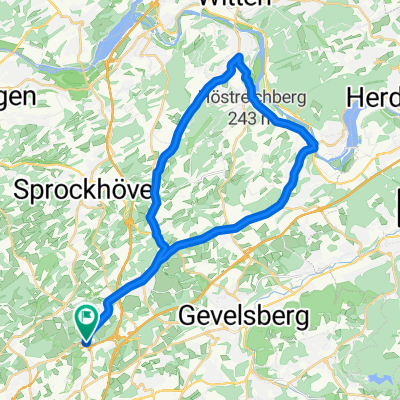
68 Km - Sprockhövel - Baldeneysee
A cycling route starting in Sprockhövel, North Rhine-Westphalia, Germany.
Overview
About this route
Die Route ist auch für Einsteiger geeignet, da kaum Höhenmeter zu bewältigen sind und überwiegend auf Asphalt entlang der Ruhr und dem Baldeneysee gefahren wird.
Lediglich die letzten 7 Km von Hattingen in Richtung Sprockhövel steigen kontinuierlich an und könnten etwas Kraft rauben.
Zahlreiche Lokale (alle auf Biker eingestellt) befinden sich entlang der Strecke.
- -:--
- Duration
- 68.5 km
- Distance
- 226 m
- Ascent
- 224 m
- Descent
- ---
- Avg. speed
- ---
- Max. altitude
Route quality
Waytypes & surfaces along the route
Waytypes
Path
47.2 km
(69 %)
Quiet road
5.2 km
(8 %)
Surfaces
Paved
57.9 km
(85 %)
Unpaved
10.5 km
(15 %)
Asphalt
56.3 km
(82 %)
Gravel
10.5 km
(15 %)
Route highlights
Points of interest along the route
Point of interest after 20.7 km

Point of interest after 29.1 km

Point of interest after 34.2 km
Überquerung des Baldeneysee am Wehr in Essen. Treppenstufen mit Auf- und Abfahrhilfen für Fahrräder sind vorhanden.

Point of interest after 61.1 km
Am Ende der ehemaligen Eisenbahntrasse (an der Shell-Tankstelle) solltet ihr diesen Wegweiser sehen. Hier bitte links halten. Über die erste beampelte Kreuzung hinweg, an der zweiten beampelten Kreuzung rechts abbiegen. Nach ca. 1 Km rechts auf den Ruhrtalradweg, dann links in Richtung Essen.

Point of interest after 62.3 km
Der Schulenbergtunnel (hier die Südeinfahrt) ist ca. 195 Meter lang.
Continue with Bikemap
Use, edit, or download this cycling route
You would like to ride 68 Km - Sprockhövel - Baldeneysee or customize it for your own trip? Here is what you can do with this Bikemap route:
Free features
- Save this route as favorite or in collections
- Copy & plan your own version of this route
- Sync your route with Garmin or Wahoo
Premium features
Free trial for 3 days, or one-time payment. More about Bikemap Premium.
- Navigate this route on iOS & Android
- Export a GPX / KML file of this route
- Create your custom printout (try it for free)
- Download this route for offline navigation
Discover more Premium features.
Get Bikemap PremiumFrom our community
Other popular routes starting in Sprockhövel
 Kuhbar-Breckerfeld-Ruhr
- Distance
- 94.1 km
- Ascent
- 692 m
- Descent
- 692 m
- Location
- Sprockhövel, North Rhine-Westphalia, Germany
 Von Sprockhövel bis Hattingen
- Distance
- 22 km
- Ascent
- 341 m
- Descent
- 445 m
- Location
- Sprockhövel, North Rhine-Westphalia, Germany
 Erkundungsfahrt Hasslinghausen - Sprockhövel
- Distance
- 18 km
- Ascent
- 157 m
- Descent
- 172 m
- Location
- Sprockhövel, North Rhine-Westphalia, Germany
 Von Ruhr zur Ruhr ab Langerfeld
- Distance
- 72 km
- Ascent
- 452 m
- Descent
- 452 m
- Location
- Sprockhövel, North Rhine-Westphalia, Germany
 Felderbachtal kleine Runde
- Distance
- 6.6 km
- Ascent
- 298 m
- Descent
- 300 m
- Location
- Sprockhövel, North Rhine-Westphalia, Germany
 Schöne Feierabendrunde
- Distance
- 33.5 km
- Ascent
- 320 m
- Descent
- 349 m
- Location
- Sprockhövel, North Rhine-Westphalia, Germany
 Von Ruhr zur Ruhr
- Distance
- 56.9 km
- Ascent
- 315 m
- Descent
- 314 m
- Location
- Sprockhövel, North Rhine-Westphalia, Germany
 68 Km - Sprockhövel - Baldeneysee
- Distance
- 68.5 km
- Ascent
- 226 m
- Descent
- 224 m
- Location
- Sprockhövel, North Rhine-Westphalia, Germany
Open it in the app