
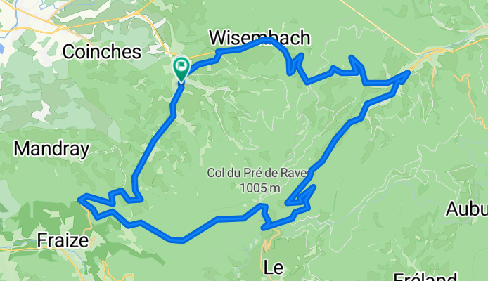
Ban de Laveline Circle CLONED FROM ROUTE 709653
A cycling route starting in Ban-de-Laveline, Grand Est, France.
Overview
About this route
- -:--
- Duration
- 45.5 km
- Distance
- 1,013 m
- Ascent
- 1,012 m
- Descent
- ---
- Avg. speed
- ---
- Max. altitude
Continue with Bikemap
Use, edit, or download this cycling route
You would like to ride Ban de Laveline Circle CLONED FROM ROUTE 709653 or customize it for your own trip? Here is what you can do with this Bikemap route:
Free features
- Save this route as favorite or in collections
- Copy & plan your own version of this route
- Sync your route with Garmin or Wahoo
Premium features
Free trial for 3 days, or one-time payment. More about Bikemap Premium.
- Navigate this route on iOS & Android
- Export a GPX / KML file of this route
- Create your custom printout (try it for free)
- Download this route for offline navigation
Discover more Premium features.
Get Bikemap PremiumFrom our community
Other popular routes starting in Ban-de-Laveline
 Ban-Schlucht-BonHomme-Raves-St.Marie-Ban
- Distance
- 100.6 km
- Ascent
- 1,762 m
- Descent
- 1,762 m
- Location
- Ban-de-Laveline, Grand Est, France
 5ème étape Fouchal - Vauthiermont
- Distance
- 112.2 km
- Ascent
- 1,558 m
- Descent
- 1,736 m
- Location
- Ban-de-Laveline, Grand Est, France
 Ban de Laveline Circle CLONED FROM ROUTE 709653
- Distance
- 45.5 km
- Ascent
- 1,013 m
- Descent
- 1,012 m
- Location
- Ban-de-Laveline, Grand Est, France
 Provenchéres sur Fave<> Col de la Schlucht
- Distance
- 54.4 km
- Ascent
- 952 m
- Descent
- 217 m
- Location
- Ban-de-Laveline, Grand Est, France
 88 Grande Rue, Provenchères-et-Colroy à Ban-de-Sapt
- Distance
- 7.6 km
- Ascent
- 975 m
- Descent
- 569 m
- Location
- Ban-de-Laveline, Grand Est, France
 fgtr
fgtr- Distance
- 128.4 km
- Ascent
- 2,333 m
- Descent
- 2,333 m
- Location
- Ban-de-Laveline, Grand Est, France
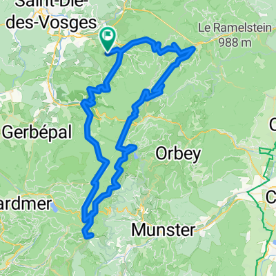
 B7_St-Die-des-Vosges - Munster
- Distance
- 81.3 km
- Ascent
- 1,757 m
- Descent
- 1,769 m
- Location
- Ban-de-Laveline, Grand Est, France
 Herfstrondje Vogezen
- Distance
- 488.3 km
- Ascent
- 3,306 m
- Descent
- 3,302 m
- Location
- Ban-de-Laveline, Grand Est, France
Open it in the app