


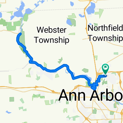
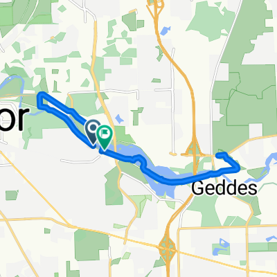
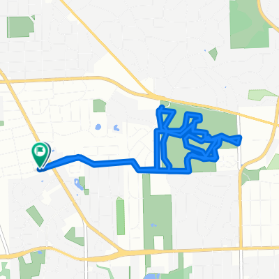
Hilldale Dr, Ann Arbor to Hilldale Dr, Ann Arbor
A cycling route starting in Ann Arbor, Michigan, United States.
Overview
About this route
0
The route begins with a gentle climb up a small hill, followed by a flat stretch for a few kilometres. After that, there is a steep ascent of around twenty metres, which will test your endurance. Once you reach the top, there is a flat section for a few kilometres, followed by a gentle descent of around twenty metres. After that, there is a steep descent of around fifty metres, which will be the most challenging part of the route. Finally, the route ends with a flat section for a few kilometres.
AI generated
- 3:14 h
- Duration
- 59.6 km
- Distance
- 228 m
- Ascent
- 226 m
- Descent
- 18.4 km/h
- Avg. speed
- 271 m
- Max. altitude
bikemapuser1022279243571957
created this 1 month ago
Route quality
Waytypes & surfaces along the route
Waytypes
Cycleway
30.4 km
51 %
Road
20.9 km
35 %
Surfaces
Paved
54.2 km
(91 %)
Unpaved
2.4 km
(4 %)
Asphalt
44.7 km
75 %
Paved (undefined)
3.6 km
6 %
Continue with Bikemap
Use, edit, or download this cycling route
You would like to ride Hilldale Dr, Ann Arbor to Hilldale Dr, Ann Arbor or customize it for your own trip? Here is what you can do with this Bikemap route:
Free features
- Save this route as favorite or in collections
- Copy & plan your own version of this route
- Sync your route with Garmin or Wahoo
Premium features
Free trial for 3 days, or one-time payment. More about Bikemap Premium.
- Navigate this route on iOS & Android
- Export a GPX / KML file of this route
- Create your custom printout (try it for free)
- Download this route for offline navigation
Discover more Premium features.
Get Bikemap PremiumFrom our community
Other popular routes starting in Ann Arbor


 Marlborough Dr, Ann Arbor to Marlborough Dr, Ann Arbor0
- 10.6 km
- 109 m
- 108 m
- Ann Arbor, Michigan, United States


Open it in the app