

Percurso Categoria PRÓ OFICIAL 2012
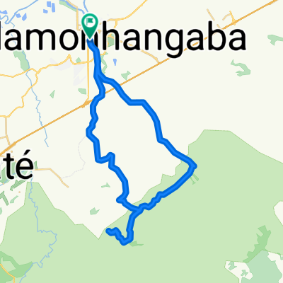
A cycling route starting in Pindamonhangaba, São Paulo, Brazil.
Overview
About this route
<h3 class="post-title entry-title" style="margin: 20px 0px 0px; position: relative; color: #fecc03; font-family: 'PT Sans'; background-color: #438cc8;">Apresentação</h3> <div class="post-header" style="line-height: 1.6; margin: 0px 0px 1em; color: #fecc03; font-family: 'PT Sans'; font-size: 14px; background-color: #438cc8;"></div> <div id="post-body-7591946958122011653" class="post-body entry-content" style="width: 610px; line-height: 19px; position: relative; color: #fecc03; font-family: 'PT Sans'; font-size: 14px; background-color: #438cc8;"> <div style="color: white; font-family: 'Trebuchet MS', sans-serif; margin: 0cm;"><span style="font-size: small;">No dia 21 de Outubro será realizada a segunda edição da UltraMTB.</span><br /><br /><span style="font-size: small;">A cidade de Pindamohangaba-SP foi escolhida como sede da competição por possuir um dos cenários mais ricos para a prática do Mountain Bike. </span></div> <div style="color: white; font-family: 'Trebuchet MS', sans-serif; margin: 0cm;"><span style="font-size: small;">A largada será na Praça do Quartel, no centro da cidade, na seguinte sequência: categoria Pro, Sport e Light - todos atrás do carro madrinha até a largada oficial em estrada de terra.</span></div> <div style="color: white; font-family: 'Trebuchet MS', sans-serif; margin: 0cm;"><span style="font-size: small;"><br /></span></div> <div style="color: white; font-family: 'Trebuchet MS', sans-serif; margin: 0cm;"><span style="font-size: small;">A etapa de 2012 terá um percurso diversificado de aproximadamente 65km para a categoria Pro, 45km para a categoria Sport e 25km para a categoria Light - todas muito bem equilibradas nos quesitos técnica, força e resistência com uma altimetria que vai intimidar os atletas da categoria Pro. </span></div> <div style="color: white; font-family: 'Trebuchet MS', sans-serif; margin: 0cm;"><span style="font-size: small;"><br /></span></div> <div style="color: white; font-family: 'Trebuchet MS', sans-serif; margin: 0cm;"><span style="font-size: small;">O cenário para esta etapa de 2012 não podia deixar de ser a majestosa Serra da Mantiqueira com suas lindas trilhas e visuais exuberantes de todo o Vale do Paraíba proporcionando um excelente e desafiador terreno para a 1ª Etapa da UltraMTB 2012.</span></div> <div style="color: white; font-family: 'Trebuchet MS', sans-serif; margin: 0cm;"><span style="font-size: small;"><br /></span></div> <div style="color: white; font-family: 'Trebuchet MS', sans-serif; margin: 0cm;"><span style="font-size: small;">A espectativa para a etapa de 2012 é de aproximadamente 500 participantes vindos de toda parte do Brasil.</span><br /><br /><span style="font-size: small;">As inscrições são limitadas!!!</span></div> </div>
- -:--
- Duration
- 65.8 km
- Distance
- 683 m
- Ascent
- 683 m
- Descent
- ---
- Avg. speed
- ---
- Avg. speed

Route highlights
Points of interest along the route
Point of interest after 5.5 km
Largada Oficial Categoria Pró
Point of interest after 14.6 km
1º PONTO DE AGUÁ
Point of interest after 25.1 km
2º PONTO DE AGUÁ
Point of interest after 52.9 km
3º PONTO DE AGUÁ
Continue with Bikemap
Use, edit, or download this cycling route
You would like to ride Percurso Categoria PRÓ OFICIAL 2012 or customize it for your own trip? Here is what you can do with this Bikemap route:
Free features
- Save this route as favorite or in collections
- Copy & plan your own version of this route
- Sync your route with Garmin or Wahoo
Premium features
Free trial for 3 days, or one-time payment. More about Bikemap Premium.
- Navigate this route on iOS & Android
- Export a GPX / KML file of this route
- Create your custom printout (try it for free)
- Download this route for offline navigation
Discover more Premium features.
Get Bikemap PremiumFrom our community
Other popular routes starting in Pindamonhangaba
 Percurso Categoria SPORT 50KM OFICIAL
- Distance
- 54.9 km
- Ascent
- 485 m
- Descent
- 485 m
- Location
- Pindamonhangaba, São Paulo, Brazil
 TREINÃO REI E RAINHA DA MONTANHA
- Distance
- 12.2 km
- Ascent
- 925 m
- Descent
- 271 m
- Location
- Pindamonhangaba, São Paulo, Brazil
 UltraMTB XC - Categorias PRÓ/SPORT
- Distance
- 38.4 km
- Ascent
- 657 m
- Descent
- 657 m
- Location
- Pindamonhangaba, São Paulo, Brazil
 Pinda - Campos de Cunha
- Distance
- 103.1 km
- Ascent
- 1,267 m
- Descent
- 788 m
- Location
- Pindamonhangaba, São Paulo, Brazil
 Pedal ICPinda X Estrada do Borba X Serrinha X Estrada Pinhão do Borba
- Distance
- 54 km
- Ascent
- 683 m
- Descent
- 683 m
- Location
- Pindamonhangaba, São Paulo, Brazil
 UltraMTB 2015 - Categoria PRÓ
- Distance
- 56.1 km
- Ascent
- 739 m
- Descent
- 739 m
- Location
- Pindamonhangaba, São Paulo, Brazil
 Percurso categoria LIGHT 25KM OFICIAL
- Distance
- 26.1 km
- Ascent
- 160 m
- Descent
- 162 m
- Location
- Pindamonhangaba, São Paulo, Brazil
 Percurso Categoria PRÓ OFICIAL 2012
- Distance
- 65.8 km
- Ascent
- 683 m
- Descent
- 683 m
- Location
- Pindamonhangaba, São Paulo, Brazil
Open it in the app