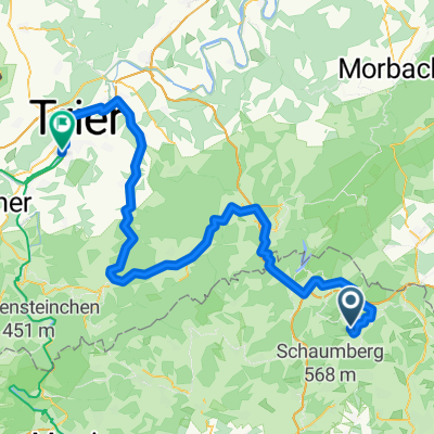
Premium Feierabendtour
A cycling route starting in Oberthal, Saarland, Germany.
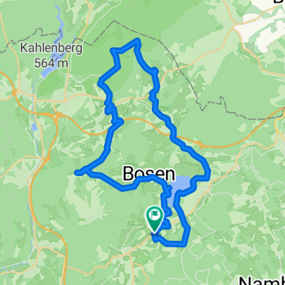
Overview
About this route
Schöne abwechslungsreiche Feierabendtour mit Start und Ziel in St.Wendel/Winterbach. Schöne Trails und Abstecher auf die saarländischen "Premium" Wanderwege (5-Weiher-Tour, Rötelsteinpfad, Offizierspfad Imsbach). Für geübte Biker fast komplett fahrbar. :-)
ca.40km, 850hm, 2,5-3h Fahrzeit
- -:--
- Duration
- 39.8 km
- Distance
- 688 m
- Ascent
- 641 m
- Descent
- ---
- Avg. speed
- 516 m
- Avg. speed
Route quality
Waytypes & surfaces along the route
Waytypes
Track
14.3 km
(36 %)
Path
12.3 km
(31 %)
Surfaces
Paved
19.3 km
(49 %)
Unpaved
11 km
(28 %)
Asphalt
12.8 km
(32 %)
Paved (undefined)
6.1 km
(15 %)
Continue with Bikemap
Use, edit, or download this cycling route
You would like to ride Premium Feierabendtour or customize it for your own trip? Here is what you can do with this Bikemap route:
Free features
- Save this route as favorite or in collections
- Copy & plan your own version of this route
- Sync your route with Garmin or Wahoo
Premium features
Free trial for 3 days, or one-time payment. More about Bikemap Premium.
- Navigate this route on iOS & Android
- Export a GPX / KML file of this route
- Create your custom printout (try it for free)
- Download this route for offline navigation
Discover more Premium features.
Get Bikemap PremiumFrom our community
Other popular routes starting in Oberthal
- Güdesw.-Buchwald-Bost.See-
- Distance
- 28.2 km
- Ascent
- 336 m
- Descent
- 342 m
- Location
- Oberthal, Saarland, Germany
- Schaumbergtrails mit Hofgut Imsbach
- Distance
- 43.8 km
- Ascent
- 849 m
- Descent
- 849 m
- Location
- Oberthal, Saarland, Germany
- RT 61km Neunkirchen(Nahe)-Thallichtenberg-Oberkirchen-Reitscheid-Assweiler-Wallhausen-Neubrücke-Nk
- Distance
- 61.1 km
- Ascent
- 1,425 m
- Descent
- 1,583 m
- Location
- Oberthal, Saarland, Germany
- 20141026_100525
- Distance
- 36 km
- Ascent
- 427 m
- Descent
- 424 m
- Location
- Oberthal, Saarland, Germany
- Güdesweiler - Bliesen - Baltersweiler
- Distance
- 15.3 km
- Ascent
- 214 m
- Descent
- 216 m
- Location
- Oberthal, Saarland, Germany
- Nahe-Radweg
- Distance
- 133.7 km
- Ascent
- 1,818 m
- Descent
- 2,198 m
- Location
- Oberthal, Saarland, Germany
- Nahe-Quellen-weg
- Distance
- 4.6 km
- Ascent
- 131 m
- Descent
- 155 m
- Location
- Oberthal, Saarland, Germany
- Ob-N-Nahe-Eiw-Peterberg
- Distance
- 13.3 km
- Ascent
- 418 m
- Descent
- 136 m
- Location
- Oberthal, Saarland, Germany
Open it in the app