

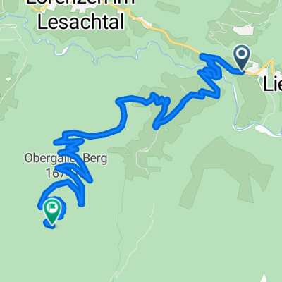
Obergailer Berg - Hurde
A cycling route starting in Untertilliach, Tyrol, Austria.
Overview
About this route
- -:--
- Duration
- 10.2 km
- Distance
- 878 m
- Ascent
- 170 m
- Descent
- ---
- Avg. speed
- ---
- Max. altitude
Continue with Bikemap
Use, edit, or download this cycling route
You would like to ride Obergailer Berg - Hurde or customize it for your own trip? Here is what you can do with this Bikemap route:
Free features
- Save this route as favorite or in collections
- Copy & plan your own version of this route
- Sync your route with Garmin or Wahoo
Premium features
Free trial for 3 days, or one-time payment. More about Bikemap Premium.
- Navigate this route on iOS & Android
- Export a GPX / KML file of this route
- Create your custom printout (try it for free)
- Download this route for offline navigation
Discover more Premium features.
Get Bikemap PremiumFrom our community
Other popular routes starting in Untertilliach
 Seineckenrunde
- Distance
- 11.8 km
- Ascent
- 425 m
- Descent
- 429 m
- Location
- Untertilliach, Tyrol, Austria
 OT-20: Untertilliach - Kreuzbergpass - Abfahrt bis Padola und zurück
- Distance
- 128.4 km
- Ascent
- 1,978 m
- Descent
- 1,978 m
- Location
- Untertilliach, Tyrol, Austria
 Oberraster Alm - Motalpe - Liesing
- Distance
- 17.8 km
- Ascent
- 863 m
- Descent
- 865 m
- Location
- Untertilliach, Tyrol, Austria
 Oberraste
- Distance
- 12.4 km
- Ascent
- 702 m
- Descent
- 702 m
- Location
- Untertilliach, Tyrol, Austria
 Über die Almen
- Distance
- 26.8 km
- Ascent
- 1,154 m
- Descent
- 1,154 m
- Location
- Untertilliach, Tyrol, Austria
 Maria Luggau -
- Distance
- 26.3 km
- Ascent
- 626 m
- Descent
- 1,089 m
- Location
- Untertilliach, Tyrol, Austria
 Liesing 31 nach Liesing 16, Lesachtal
- Distance
- 17.1 km
- Ascent
- 966 m
- Descent
- 952 m
- Location
- Untertilliach, Tyrol, Austria
 Obergailer Hurde
- Distance
- 9.6 km
- Ascent
- 791 m
- Descent
- 89 m
- Location
- Untertilliach, Tyrol, Austria
Open it in the app