

Scenic Steady Climb
A cycling route starting in Paradise Valley, Arizona, United States.
Overview
About this route
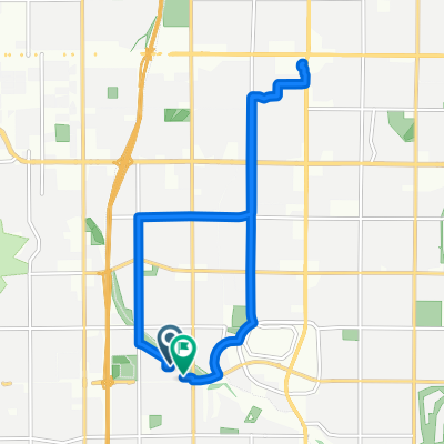
Good steady climb for intermediate riders. Scenic views and pretty safe with bike lanes and less traffic, with Dynamite Blvd being the exception. Great morning ride to get the heart pumping.
- -:--
- Duration
- 38.2 km
- Distance
- 414 m
- Ascent
- 414 m
- Descent
- ---
- Avg. speed
- ---
- Max. altitude
Route quality
Waytypes & surfaces along the route
Waytypes
Road
21 km
(55 %)
Quiet road
2.3 km
(6 %)
Undefined
14.9 km
(39 %)
Surfaces
Paved
38.2 km
(100 %)
Asphalt
38.2 km
(100 %)
Continue with Bikemap
Use, edit, or download this cycling route
You would like to ride Scenic Steady Climb or customize it for your own trip? Here is what you can do with this Bikemap route:
Free features
- Save this route as favorite or in collections
- Copy & plan your own version of this route
- Sync your route with Garmin or Wahoo
Premium features
Free trial for 3 days, or one-time payment. More about Bikemap Premium.
- Navigate this route on iOS & Android
- Export a GPX / KML file of this route
- Create your custom printout (try it for free)
- Download this route for offline navigation
Discover more Premium features.
Get Bikemap PremiumFrom our community
Other popular routes starting in Paradise Valley
 Day 2 12Apr18
- Distance
- 49.8 km
- Ascent
- 393 m
- Descent
- 393 m
- Location
- Paradise Valley, Arizona, United States
 Home to Gym
- Distance
- 7 km
- Ascent
- 10 m
- Descent
- 9 m
- Location
- Paradise Valley, Arizona, United States
 somo
somo- Distance
- 42.8 km
- Ascent
- 165 m
- Descent
- 235 m
- Location
- Paradise Valley, Arizona, United States
 Sanctuary - 42.7Km
- Distance
- 42.8 km
- Ascent
- 125 m
- Descent
- 125 m
- Location
- Paradise Valley, Arizona, United States
 Arcadia Loop
- Distance
- 26.6 km
- Ascent
- 63 m
- Descent
- 65 m
- Location
- Paradise Valley, Arizona, United States
 North 39th Street to North 39th Street
- Distance
- 14.1 km
- Ascent
- 50 m
- Descent
- 24 m
- Location
- Paradise Valley, Arizona, United States
 N Mtn and AZ Canal Ride
- Distance
- 58 km
- Ascent
- 66 m
- Descent
- 66 m
- Location
- Paradise Valley, Arizona, United States
 Route to East San Salvador Drive
- Distance
- 37.1 km
- Ascent
- 198 m
- Descent
- 155 m
- Location
- Paradise Valley, Arizona, United States
Open it in the app