

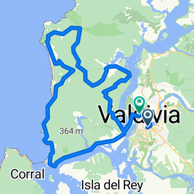
Track Hacia Cabo Blanco/Estero Santa Rosa
A cycling route starting in Valdivia, Los Ríos Region, Chile.
Overview
About this route
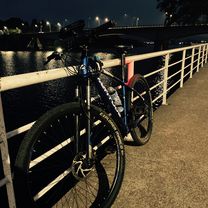
A little sprint after a long day of work, with my girlfriend =)
- -:--
- Duration
- 20.8 km
- Distance
- 68 m
- Ascent
- 68 m
- Descent
- ---
- Avg. speed
- ---
- Max. altitude

Continue with Bikemap
Use, edit, or download this cycling route
You would like to ride Track Hacia Cabo Blanco/Estero Santa Rosa or customize it for your own trip? Here is what you can do with this Bikemap route:
Free features
- Save this route as favorite or in collections
- Copy & plan your own version of this route
- Sync your route with Garmin or Wahoo
Premium features
Free trial for 3 days, or one-time payment. More about Bikemap Premium.
- Navigate this route on iOS & Android
- Export a GPX / KML file of this route
- Create your custom printout (try it for free)
- Download this route for offline navigation
Discover more Premium features.
Get Bikemap PremiumFrom our community
Other popular routes starting in Valdivia
 De Alonso de Benítez 1912, Valdivia a Alonso de Benítez 1912, Valdivia
- Distance
- 19.5 km
- Ascent
- 107 m
- Descent
- 110 m
- Location
- Valdivia, Los Ríos Region, Chile
 Carlos Anwandter 790, Valdivia a Avenida Arturo Prat 1505–1549, Valdivia
- Distance
- 19.8 km
- Ascent
- 161 m
- Descent
- 165 m
- Location
- Valdivia, Los Ríos Region, Chile
 III VERSION XTREM DESAFIO GLORIAS DEL EJERCITO
- Distance
- 85.3 km
- Ascent
- 1,357 m
- Descent
- 1,364 m
- Location
- Valdivia, Los Ríos Region, Chile
 Track Hacia Cabo Blanco/Estero Santa Rosa
- Distance
- 20.8 km
- Ascent
- 68 m
- Descent
- 68 m
- Location
- Valdivia, Los Ríos Region, Chile
 proyecto ciclotur 2014 engel y topita
- Distance
- 286.7 km
- Ascent
- 1,904 m
- Descent
- 1,902 m
- Location
- Valdivia, Los Ríos Region, Chile
 Mirador Norte (Valdivia)
- Distance
- 9.3 km
- Ascent
- 266 m
- Descent
- 38 m
- Location
- Valdivia, Los Ríos Region, Chile
 Ruta liga Inter ciudades Valdivia
- Distance
- 63.3 km
- Ascent
- 1,594 m
- Descent
- 1,529 m
- Location
- Valdivia, Los Ríos Region, Chile
 Isla Teja circuit
- Distance
- 16.6 km
- Ascent
- 304 m
- Descent
- 305 m
- Location
- Valdivia, Los Ríos Region, Chile
Open it in the app