

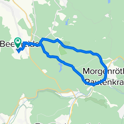
Beerheide - Kammweg bis Henneberg - Böhmen
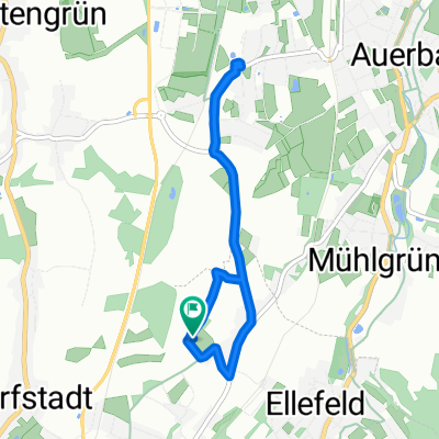
A cycling route starting in Ellefeld, Saxony, Germany.
Overview
About this route
Beerheide > Vogtlandsee > Morgenröthe-Rautenkranz > Sachsengrund > Kammweg via Weitersglashütte to Henneberg > Jeleni (Hirschenstand) > Nové Hamry (Neuhammer) > Nejdek (Neudek) > Vysoká Pec (Hochofen) > Rudné (Trinksaifen) > Prebuz (Frühbuß) > Kammweg > Sachsengrund > Morgenröthe-Rautenkranz > Vogtlandsee > Beerheide.
Route characteristics: Mostly water-bound forest paths and asphalted side roads with some climbs.
When uploading the GPX files to wandermap or bikemap, the waypoints with indicators, e.g. to hiking signs, are not transferred. Additionally, the downloaded GPX files do not contain altitude values.
The GPX files I provided are additionally stored with the waypoints and altitude values at http://www.wolf-klepzig.de/hp/rad/{xxx}.gpx.
Information on downloading and opening the GPX files, e.g. in GoogleEarth, as well as the route descriptions, often with access and parking options (coordinates), can be accessed at http://www.wolf-klepzig.de/hp/rad.htm.
Route description: http://www.wolf-klepzig.de/hp/rad/Beerheide-Henneberg-Boehmen-Beerheide.pdf
Track with information at waypoints and elevations: http://www.wolf-klepzig.de/hp/rad/Beerheide-Henneberg-Boehmen-Beerheide_83km.gpx
- -:--
- Duration
- 83 km
- Distance
- 1,122 m
- Ascent
- 1,091 m
- Descent
- ---
- Avg. speed
- 955 m
- Max. altitude
Route quality
Waytypes & surfaces along the route
Waytypes
Track
41.5 km
(50 %)
Road
36.5 km
(44 %)
Surfaces
Paved
29 km
(35 %)
Unpaved
39 km
(47 %)
Gravel
29 km
(35 %)
Asphalt
27.4 km
(33 %)
Route highlights
Points of interest along the route
Accommodation after 21.7 km
Gaststätten Kranichsee und Waldhaus
Point of interest after 28.9 km
Gaststätte Henneberg
Point of interest after 29.1 km
Hochmoor Kleiner Kranichsee
Point of interest after 70.5 km
Gaststätte
Point of interest after 80.2 km
Vogtlandsee, Wasser sauber, aber durch Moorgebiet leicht braun. Textil- und FKK-Badende.
Continue with Bikemap
Use, edit, or download this cycling route
You would like to ride Beerheide - Kammweg bis Henneberg - Böhmen or customize it for your own trip? Here is what you can do with this Bikemap route:
Free features
- Save this route as favorite or in collections
- Copy & plan your own version of this route
- Split it into stages to create a multi-day tour
- Sync your route with Garmin or Wahoo
Premium features
Free trial for 3 days, or one-time payment. More about Bikemap Premium.
- Navigate this route on iOS & Android
- Export a GPX / KML file of this route
- Create your custom printout (try it for free)
- Download this route for offline navigation
Discover more Premium features.
Get Bikemap PremiumFrom our community
Other popular routes starting in Ellefeld
 von Ellefeld über die Bahnstrecke Falkenstein nach Oelsnitz
- Distance
- 21.2 km
- Ascent
- 190 m
- Descent
- 298 m
- Location
- Ellefeld, Saxony, Germany
 göltschtalradweg etape1
- Distance
- 12 km
- Ascent
- 133 m
- Descent
- 294 m
- Location
- Ellefeld, Saxony, Germany
 Hammerbrücker Straße 8, Ellefeld nach Limbacher Straße 5, Treuen
- Distance
- 16.5 km
- Ascent
- 196 m
- Descent
- 256 m
- Location
- Ellefeld, Saxony, Germany
 ellefeld - oelsnitz
- Distance
- 23.2 km
- Ascent
- 324 m
- Descent
- 418 m
- Location
- Ellefeld, Saxony, Germany
 Röthelstein
- Distance
- 14.1 km
- Ascent
- 364 m
- Descent
- 375 m
- Location
- Ellefeld, Saxony, Germany
 Falkenstein über Kuhberg Rodewisch zurück
- Distance
- 39.4 km
- Ascent
- 567 m
- Descent
- 554 m
- Location
- Ellefeld, Saxony, Germany
 Garten Rewe zurück
- Distance
- 5.5 km
- Ascent
- 67 m
- Descent
- 64 m
- Location
- Ellefeld, Saxony, Germany
 Auerbach/Vogtland nach Buchenweg 5, Auerbach/Vogtland
- Distance
- 13.3 km
- Ascent
- 79 m
- Descent
- 185 m
- Location
- Ellefeld, Saxony, Germany
Open it in the app