

Salisbury Loop
A cycling route starting in Salisbury, South Australia, Australia.
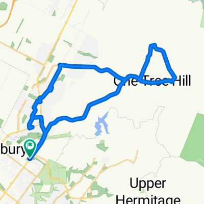
Overview
About this route
- -:--
- Duration
- 24.7 km
- Distance
- 98 m
- Ascent
- 97 m
- Descent
- ---
- Avg. speed
- ---
- Max. altitude
Continue with Bikemap
Use, edit, or download this cycling route
You would like to ride Salisbury Loop or customize it for your own trip? Here is what you can do with this Bikemap route:
Free features
- Save this route as favorite or in collections
- Copy & plan your own version of this route
- Sync your route with Garmin or Wahoo
Premium features
Free trial for 3 days, or one-time payment. More about Bikemap Premium.
- Navigate this route on iOS & Android
- Export a GPX / KML file of this route
- Create your custom printout (try it for free)
- Download this route for offline navigation
Discover more Premium features.
Get Bikemap PremiumFrom our community
Other popular routes starting in Salisbury
 Clock Tower/Bridge Rd loop
- Distance
- 21.2 km
- Ascent
- 298 m
- Descent
- 298 m
- Location
- Salisbury, South Australia, Australia
 Port Wakefield Rd, Bolivar to 31 Galway Tce, Largs North
- Distance
- 19 km
- Ascent
- 26 m
- Descent
- 33 m
- Location
- Salisbury, South Australia, Australia
 Lyndoch 2020-05-29T12:32:38
- Distance
- 51 km
- Ascent
- 236 m
- Descent
- 78 m
- Location
- Salisbury, South Australia, Australia
 One Tree hill to Holden hill
- Distance
- 64 km
- Ascent
- 633 m
- Descent
- 633 m
- Location
- Salisbury, South Australia, Australia
 1tree2005
- Distance
- 18.2 km
- Ascent
- 254 m
- Descent
- 17 m
- Location
- Salisbury, South Australia, Australia
 High-speed route in Semaphore
- Distance
- 20 km
- Ascent
- 9 m
- Descent
- 18 m
- Location
- Salisbury, South Australia, Australia
 Mawson Lakes
- Distance
- 20.6 km
- Ascent
- 92 m
- Descent
- 93 m
- Location
- Salisbury, South Australia, Australia
 One Tree Hill Loop
- Distance
- 38.8 km
- Ascent
- 362 m
- Descent
- 363 m
- Location
- Salisbury, South Australia, Australia
Open it in the app