Béjar - Navacarros - San Bartolo - Sorihuela - Vallejera - Navacarros - Béjar
A cycling route starting in Béjar, Castille and León, Spain.
Overview
About this route
Route of the 'toboggans' or the 'dunes'. We start from the Corredera de Béjar heading towards Los Pinos, to climb the road from Candelario to Navacarros. Once in the village, we take the GR-10 trail, which will lead us to the road ascending to the La Covatilla ski resort. From here, the path is very technical, with loose stones and steep descents. Once at San Bartolo, we exit onto a path and then a trail, where we will encounter stones and rocks that may cause damage to our bike, so pedal with your eyes wide open. We will reach the N630a road, which we will follow up to the Alto de Vallejera and then arrive at the village. Along the old path, we will head towards Navacarros to have a Coca-Cola at La Osera, the village tavern (don't miss it!!), and gather strength to finish descending towards Béjar on the GR-10, also very technical.
Physical difficulty: medium
Technical difficulty: medium-high
Water availability: almost every 5 km, no problems.
- -:--
- Duration
- 29.8 km
- Distance
- 698 m
- Ascent
- 699 m
- Descent
- ---
- Avg. speed
- ---
- Max. altitude
Continue with Bikemap
Use, edit, or download this cycling route
You would like to ride Béjar - Navacarros - San Bartolo - Sorihuela - Vallejera - Navacarros - Béjar or customize it for your own trip? Here is what you can do with this Bikemap route:
Free features
- Save this route as favorite or in collections
- Copy & plan your own version of this route
- Sync your route with Garmin or Wahoo
Premium features
Free trial for 3 days, or one-time payment. More about Bikemap Premium.
- Navigate this route on iOS & Android
- Export a GPX / KML file of this route
- Create your custom printout (try it for free)
- Download this route for offline navigation
Discover more Premium features.
Get Bikemap PremiumFrom our community
Other popular routes starting in Béjar
Béjar - Navacarros - San Bartolo - Sorihuela - Vallejera - Navacarros - Béjar- Distance
- 29.8 km
- Ascent
- 698 m
- Descent
- 699 m
- Location
- Béjar, Castille and León, Spain
Béjar- Ruta Heidi y Vía Verde- Distance
- 77.6 km
- Ascent
- 1,425 m
- Descent
- 1,421 m
- Location
- Béjar, Castille and León, Spain
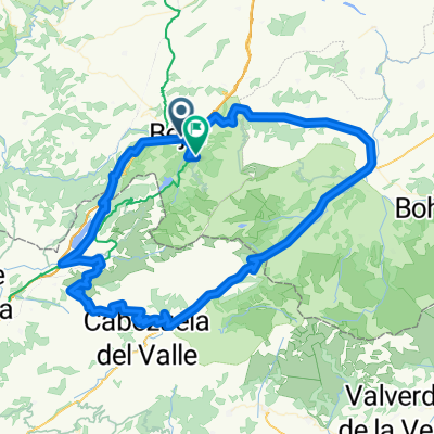
Béjar - Llano Alto - Pantano Navamuño - Candelario - Los Pinos - Béjar- Distance
- 18.6 km
- Ascent
- 470 m
- Descent
- 467 m
- Location
- Béjar, Castille and León, Spain
Béjar 1- Distance
- 82.2 km
- Ascent
- 2,185 m
- Descent
- 2,174 m
- Location
- Béjar, Castille and León, Spain
Béjar - Presa Navamuño - Cancho de la Muela - Candelario - Alto de los Pollos - Béjar- Distance
- 34.9 km
- Ascent
- 699 m
- Descent
- 700 m
- Location
- Béjar, Castille and León, Spain
Béjar - Baños de Montemayor - La Garganta - Candelario - Béjar- Distance
- 37.2 km
- Ascent
- 741 m
- Descent
- 741 m
- Location
- Béjar, Castille and León, Spain
Extramadura-03: Bejar - La Alberca- Distance
- 46.9 km
- Ascent
- 923 m
- Descent
- 821 m
- Location
- Béjar, Castille and León, Spain
Béjar - Hervás - Jerte - Barco de Ávila - Béjar- Distance
- 112.9 km
- Ascent
- 1,854 m
- Descent
- 1,854 m
- Location
- Béjar, Castille and León, Spain
Open it in the app


